|
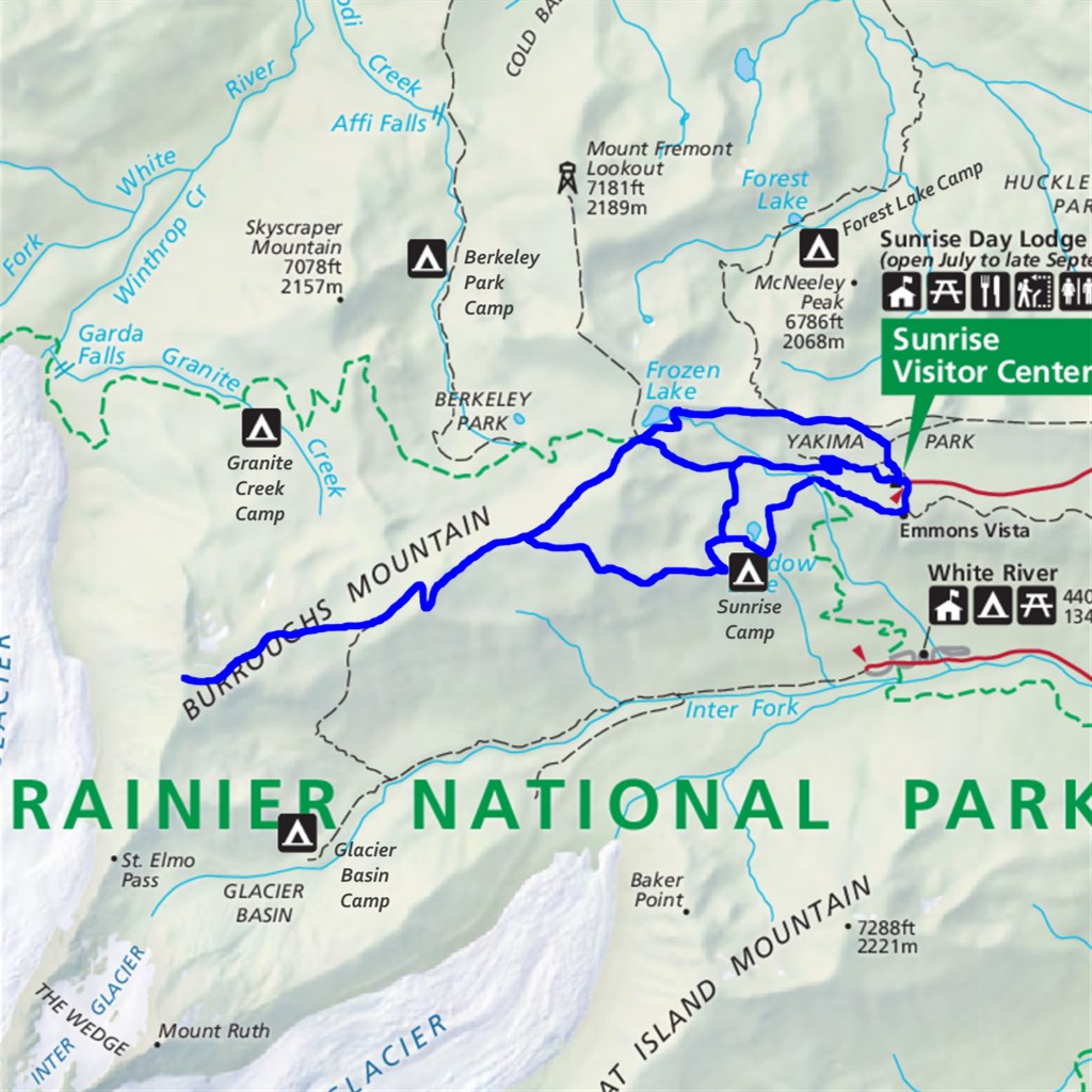
Burroughs Mountain Difficulty: moderate 9.2 miles Elevation gain: 2840' Max elevation: 7800' Camps: Sunrise First hiked by me: older |
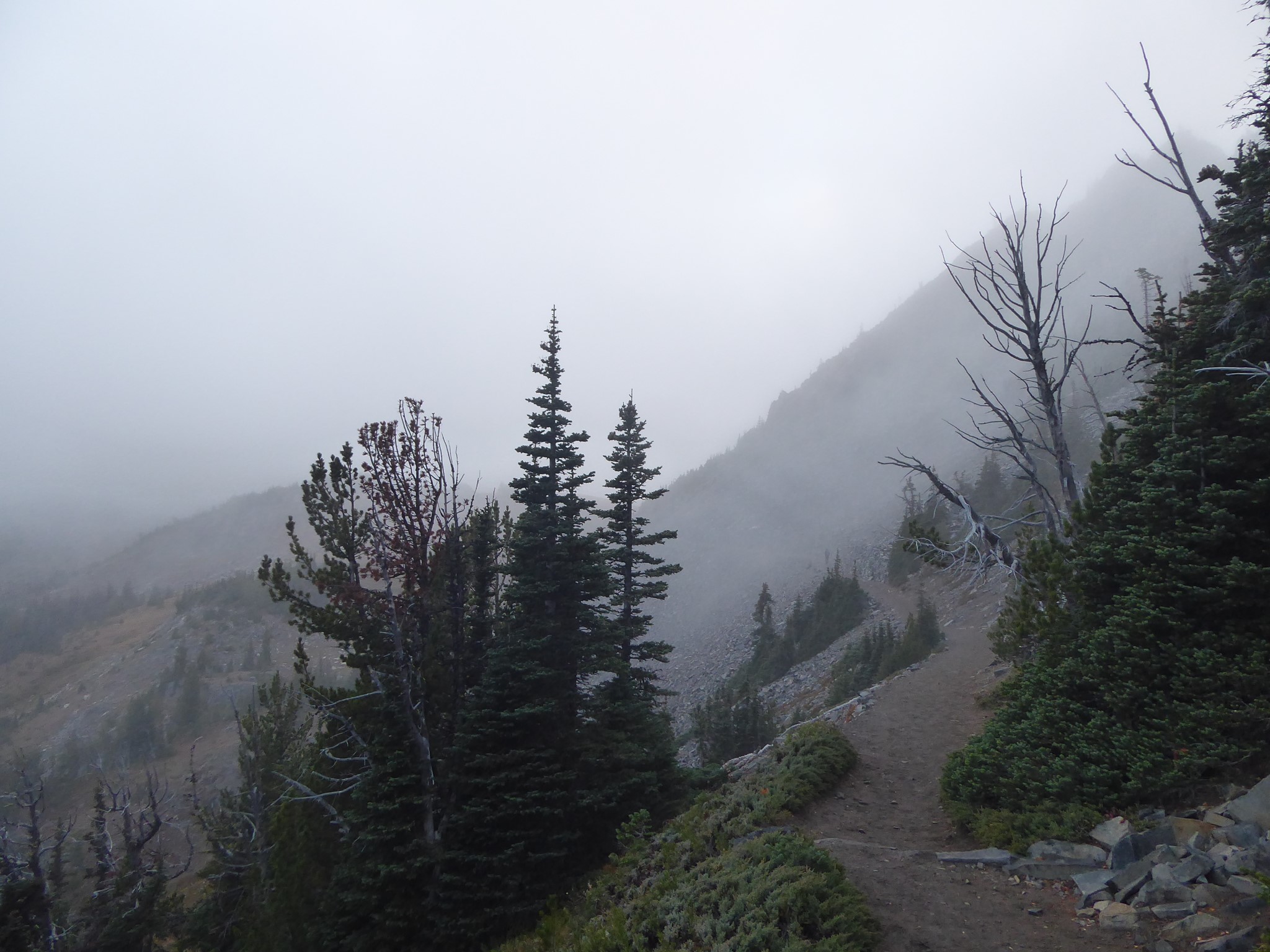
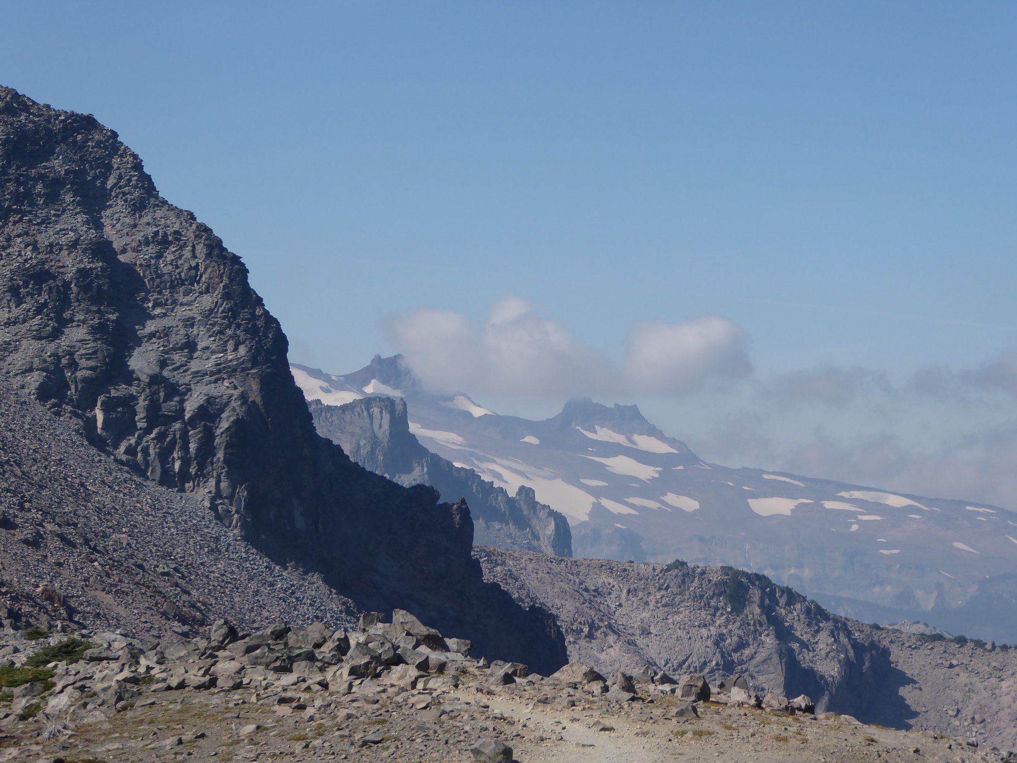
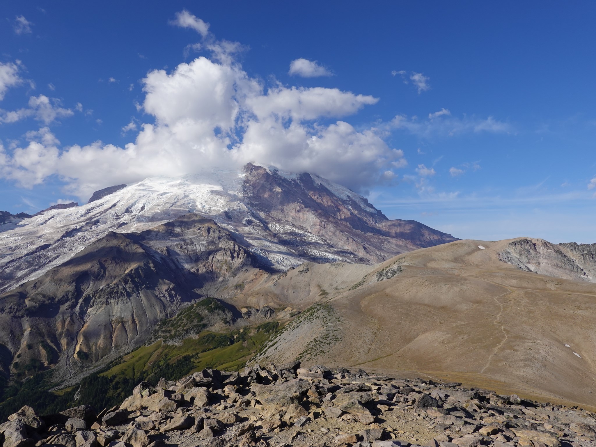
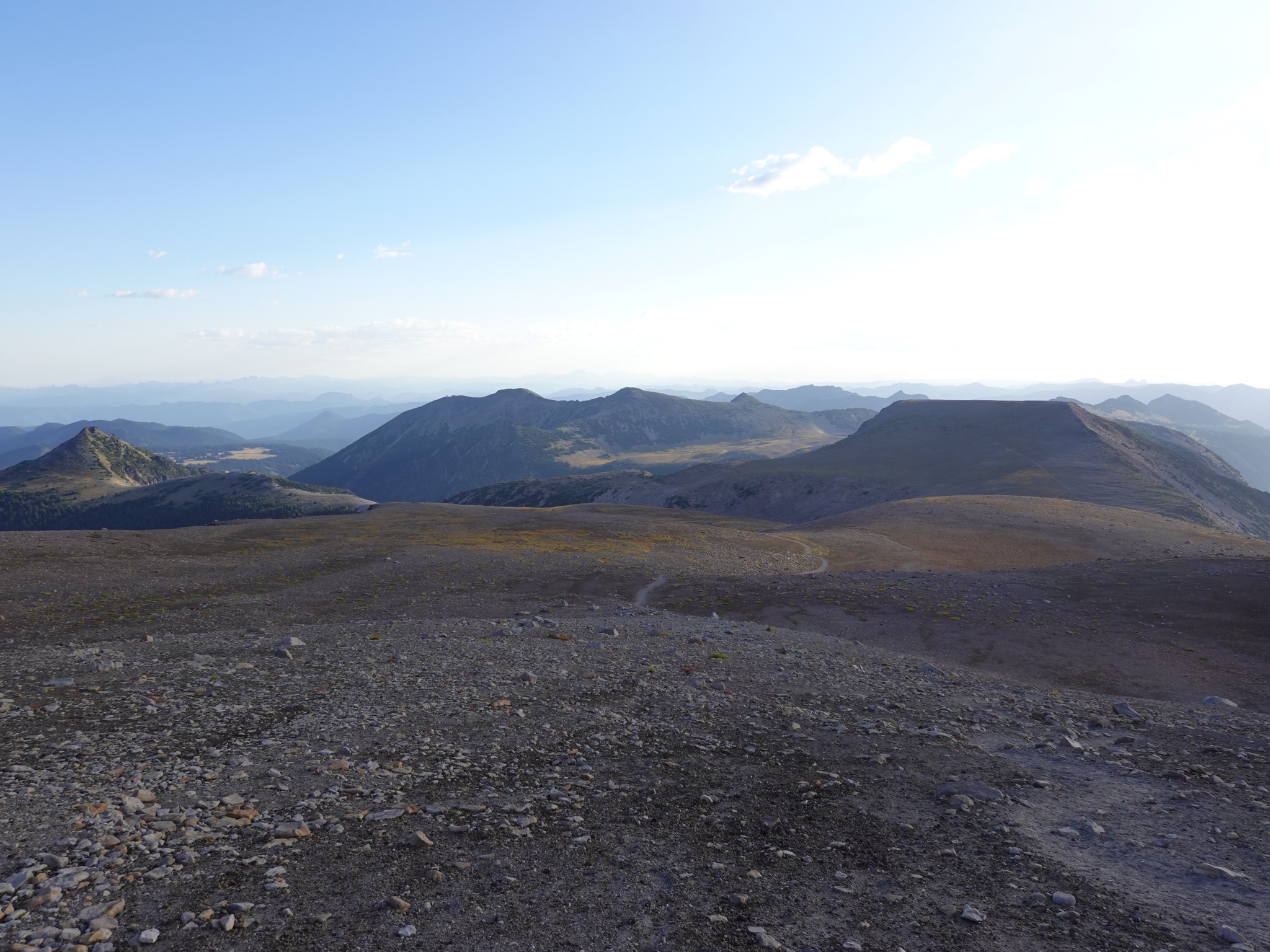
I have yet to hike on the Moon, but the otherworldly top of Burroughs Mountain is close to how I imagine that might feel. It's a giant ridge formed by an ancient lava flow, high on the northeast flank of Rainier. The combination of altitude and rain shadow dryness creates a fragile alpine tundra with barren areas of dusty volcanic rock and pumice. It's extra important to stay on the trail here, to avoid damaging plants that grow very slowly in this harsh environment.
There are three distinct summits along the ridge. The figures shown above are for Third Burroughs, but many people turn around at Second Burroughs instead, cutting 3.2 miles and 1300' of climbing.
From the trailhead at Sunrise you have multiple route options. Take the high road, or the low road, or go one way and come back the other to make a partial loop.
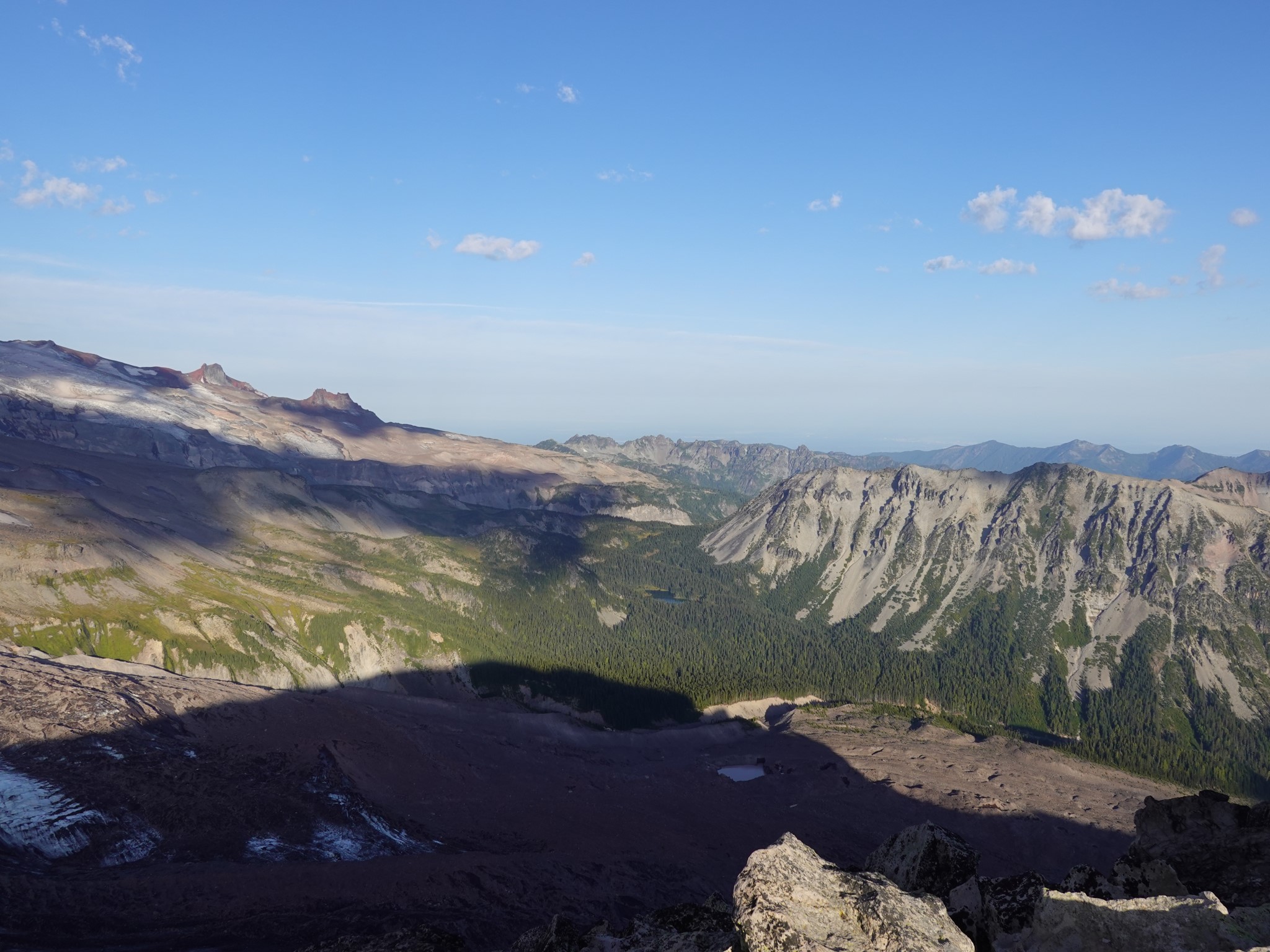
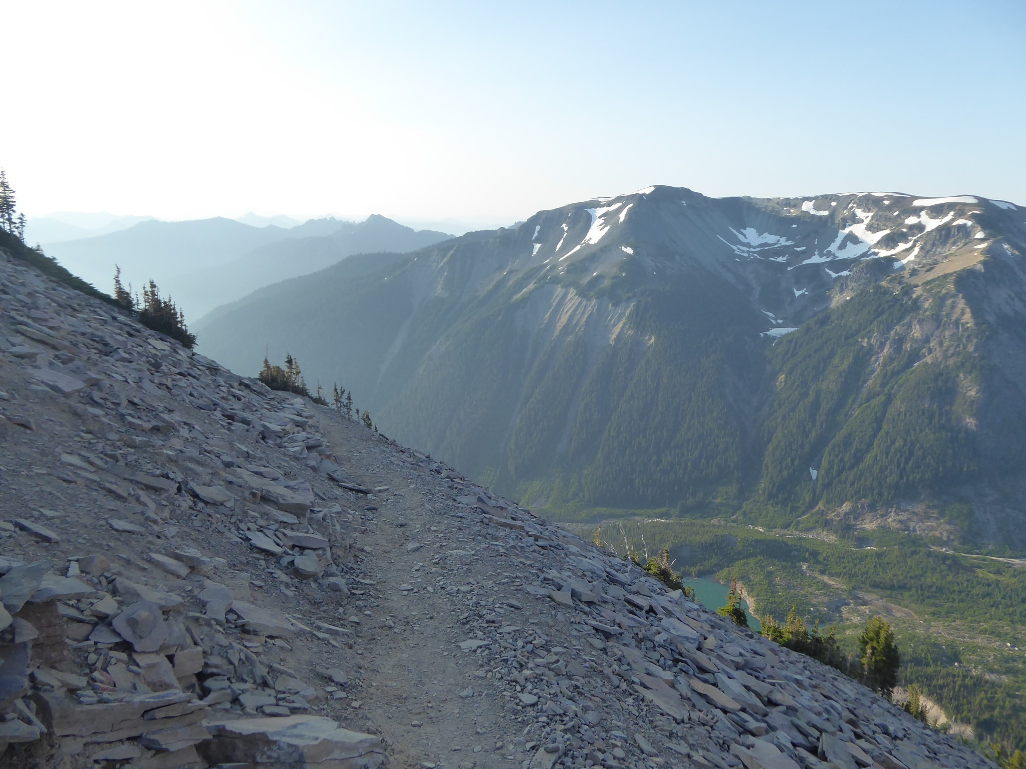
For the (northerly) high road, take your choice of several trails to the five way junction by Frozen Lake, then follow the path signposted Burroughs Mountain. This is a potentially dangerous traverse across the steep north side of First Burroughs, often snow covered until late in the summer. Watch your footing and turn back if it's icy. The green of Berkeley Park, below you to the north, makes a sharp contrast with the volcanic rock formations you are hiking over.
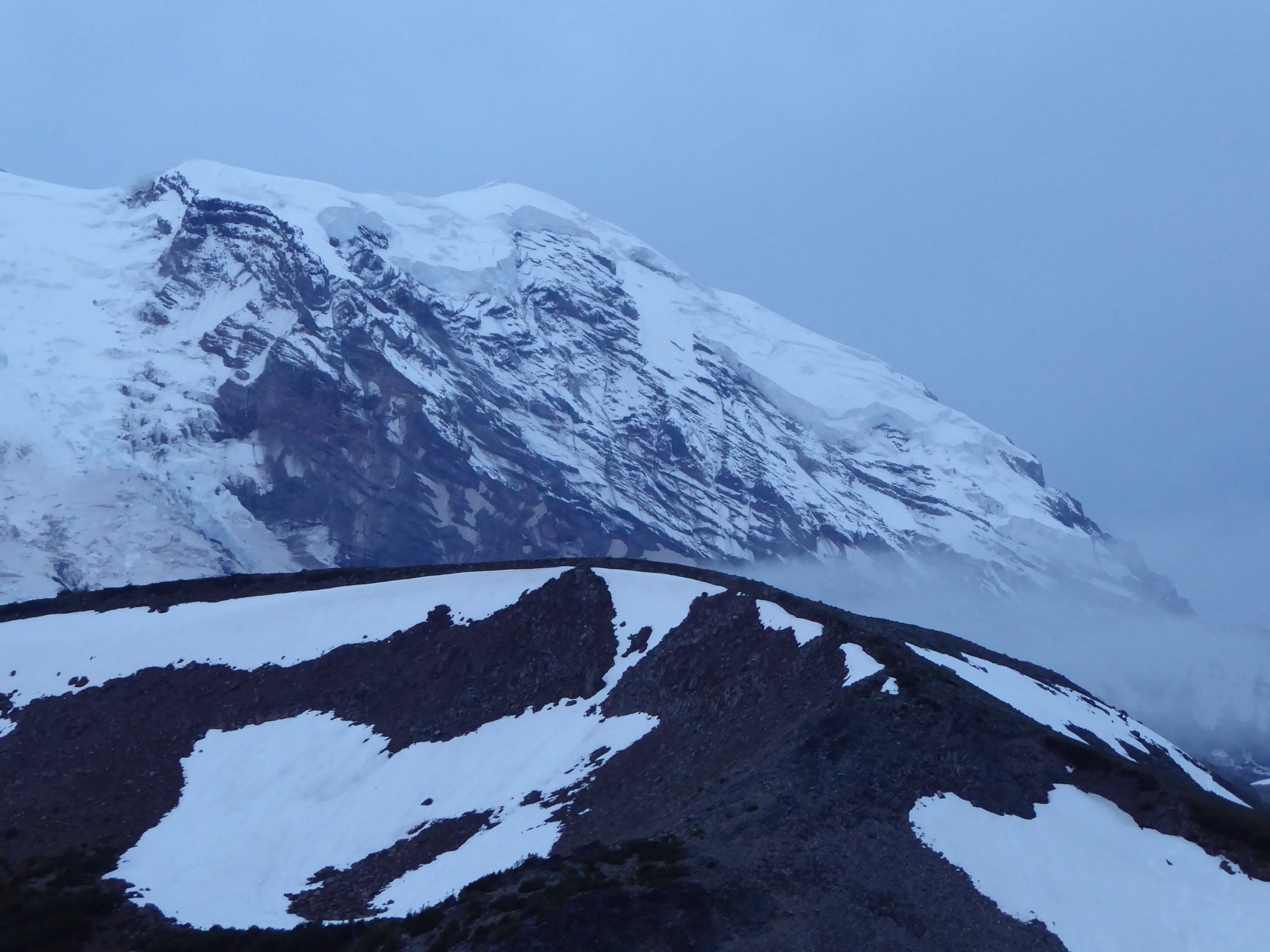
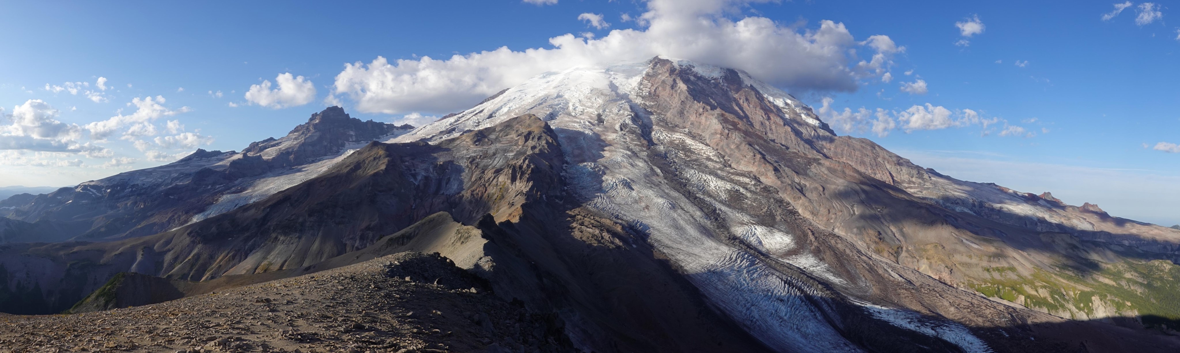
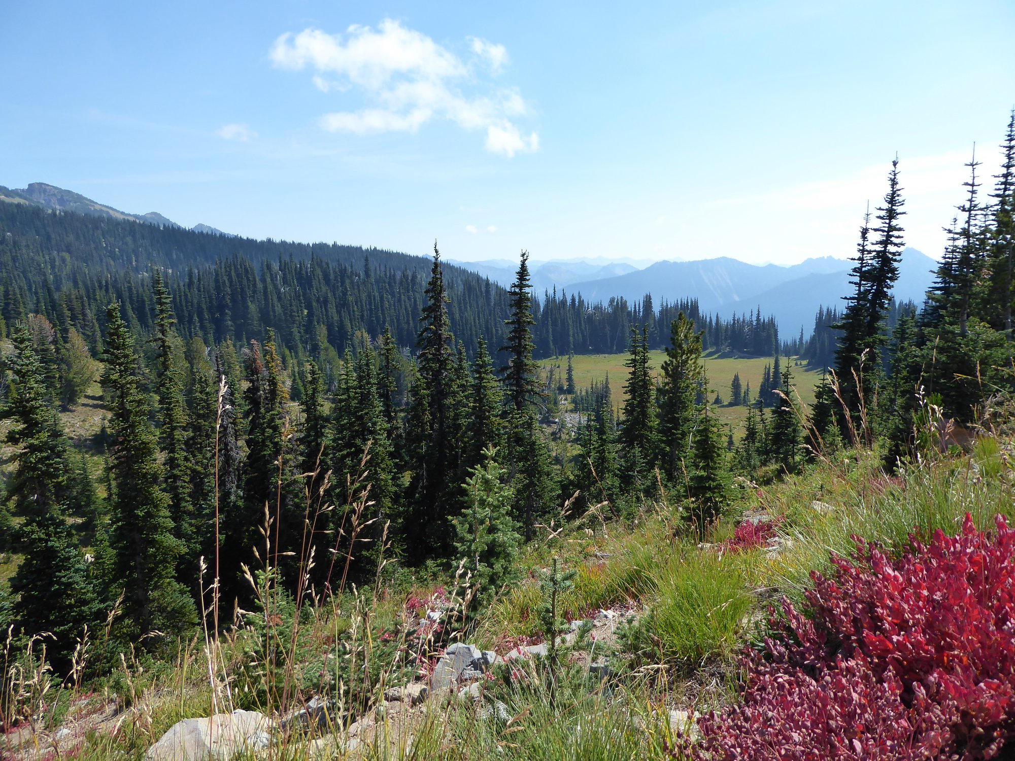
For the (southerly) low road, head west from Sunrise, turn south onto a short section of the Wonderland Trail, then west again near Shadow Lake. This route is slightly longer, trading the dramatic rocks of the northerly option for lush meadows followed by a traverse across the scree covered southern side of Burroughs with views over the Emmons Glacier.
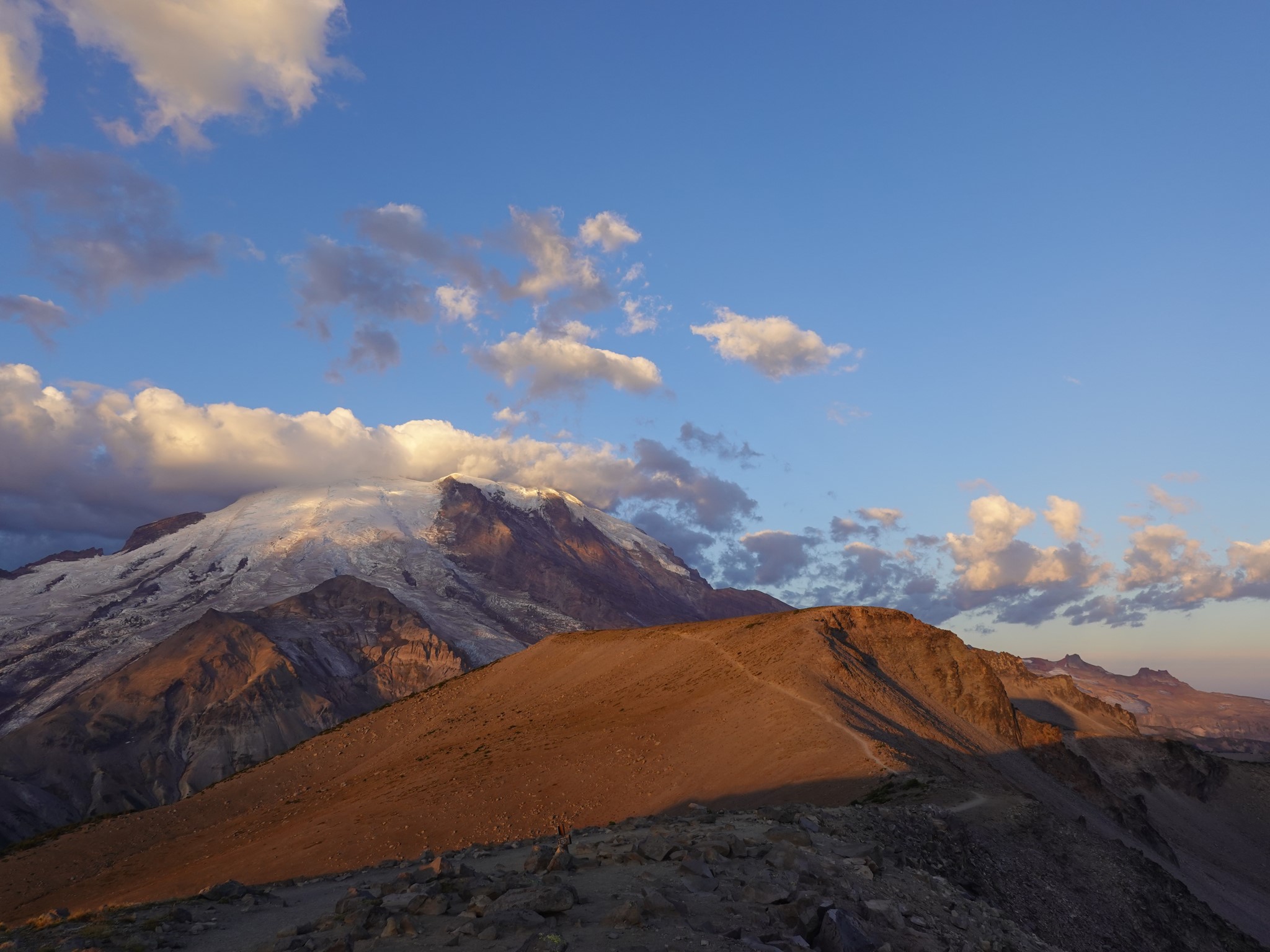
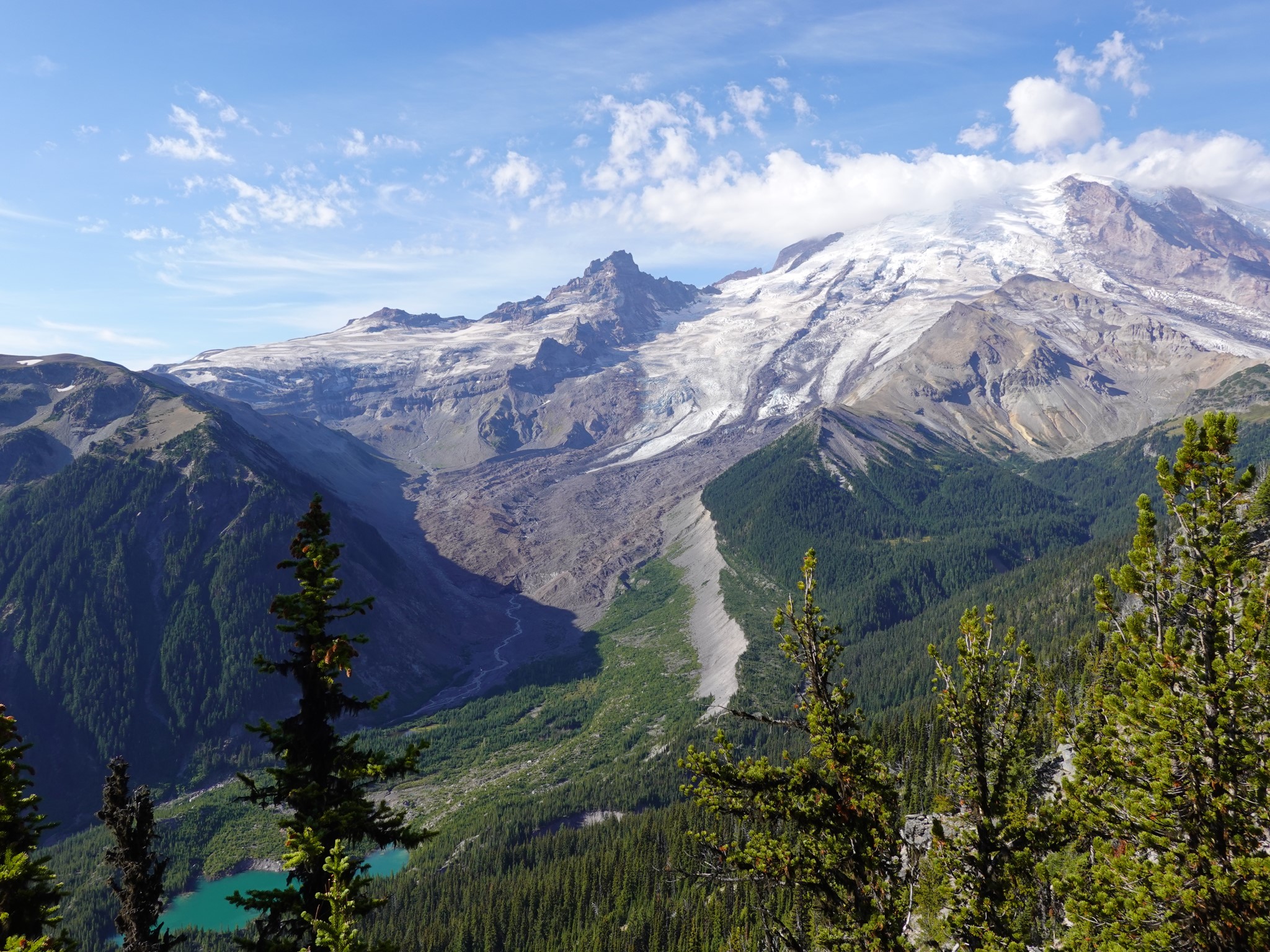
These two routes meet up near the top of First Burroughs, after which the combined trail heads up the ridge to Second Burroughs. This is a wide plateau surrounded by a circle of rocks, with a superb view of Rainier's summit.
If your legs and lungs have enough juice left, the trail continues downhill and then back up again (plus some) to Third Burroughs. At this point the summit views get truly silly, and you'll start thinking the top of Rainier seems so close, surely another half hour and you could just nip on up there? Then you'll get distracted gazing down onto the Winthrop Glacier, 2000 vertical feet below you.
This trail also forms part of the Glacier Basin / Burroughs Loop.