|
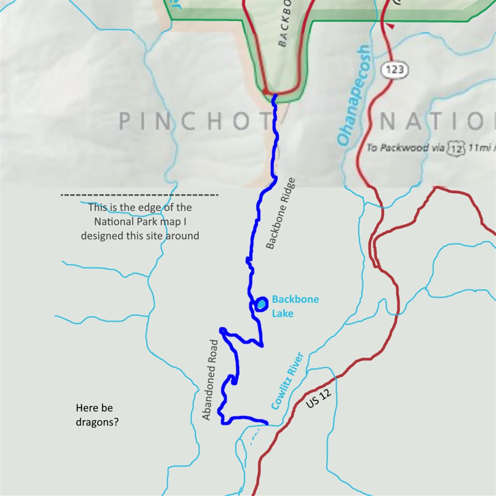
Backbone Ridge Difficulty: strenuous and unmaintained 10.8 miles Elevation gain: 2990' Max elevation: 3200' Camps: Backbone Lake (unofficial, outside MRNP) First hiked by me: 2021 |
This is an abandoned trail. Only come here if your navigation is up to the task of finding your way where there is no path to follow, and practice Leave No Trace to avoid damaging fragile terrain.
If the Skyline Trail is a digital remaster of a classic album and the Wonderland a limited edition vinyl box set, the Backbone Ridge trail is a 3rd generation cassette bootleg of a Grateful Dead show from 1973. It's unofficial, hard to find, shared by word of mouth between connoisseurs, and lacks mainstream appeal, yet there's a magic here that makes it worth preserving.
This trail has a longer history than most at Rainier, as it was used by the Taidnapam people to access the mountain from their summer camps along the Cowlitz River. Backbone Ridge refers to the lower part of what higher up becomes the Cowlitz Divide, and the route once continued all the way to the high meadow now known as Indian Bar.
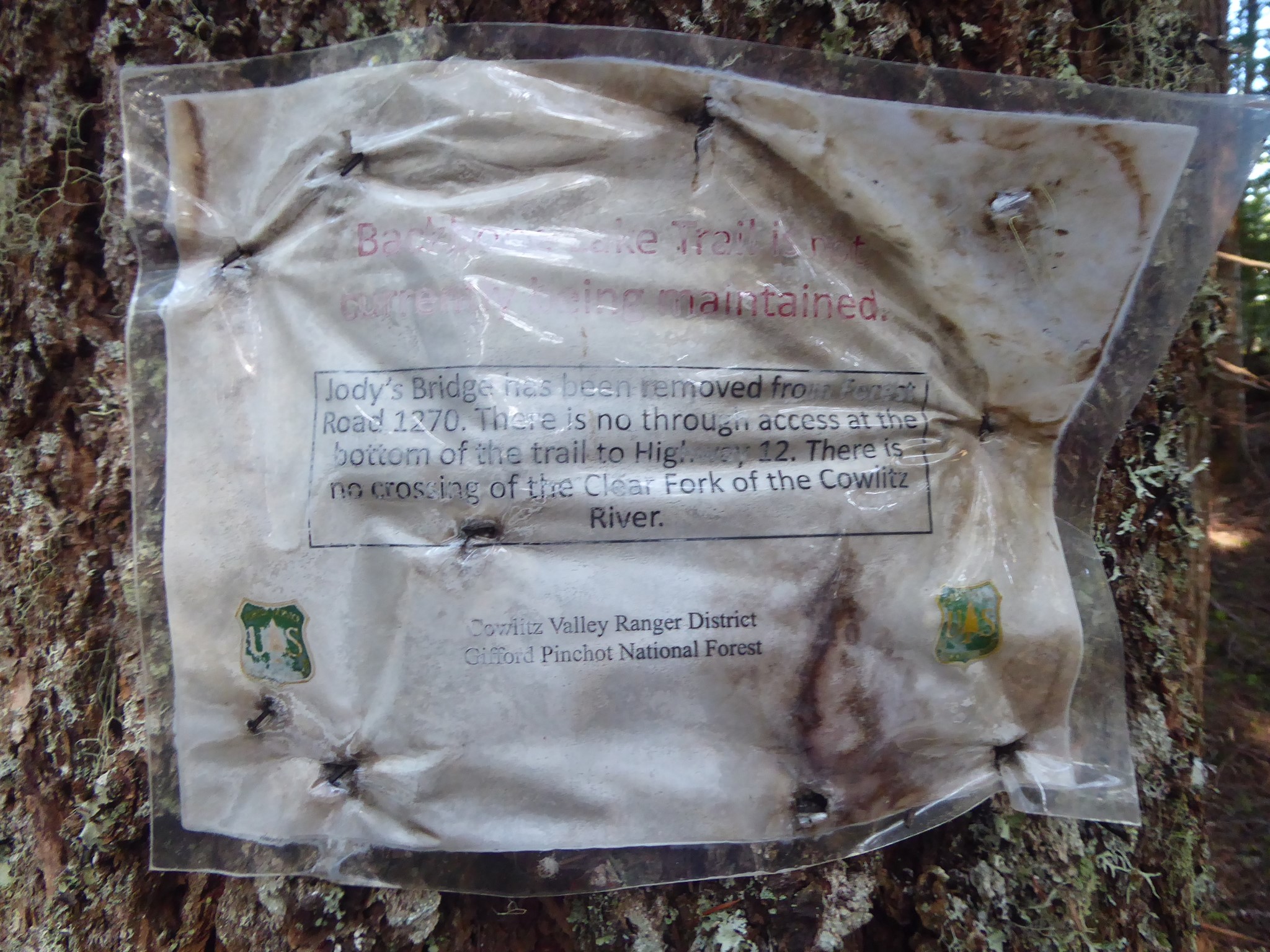
The upper part of the trail fell out of use during the second half of the 20th century. Only the section from Cowlitz River up to Stevens Canyon Road is shown on modern maps. Then in 2006, epic flooding destroyed the bridge over the Cowlitz River, leaving the trailhead inaccessible. Maintenance ceased. As of May 2021, Washington Trails Association had flagged its entry for Backbone Ridge with a red banner: "A washout on this trail has rendered this trail inaccessible". Their most recent trip report was from someone who failed to reach the trail in 2018 due to the missing bridge, and the last report of a successful hike was dated 2007.
But the trail has two ends! Perhaps I could hike it the other way, heading down from Stevens Canyon Road rather than up from the Cowlitz River? I had no idea what to expect when I set out to visit Backbone Ridge, and was fully anticipating having to turn around due to no path remaining at all.
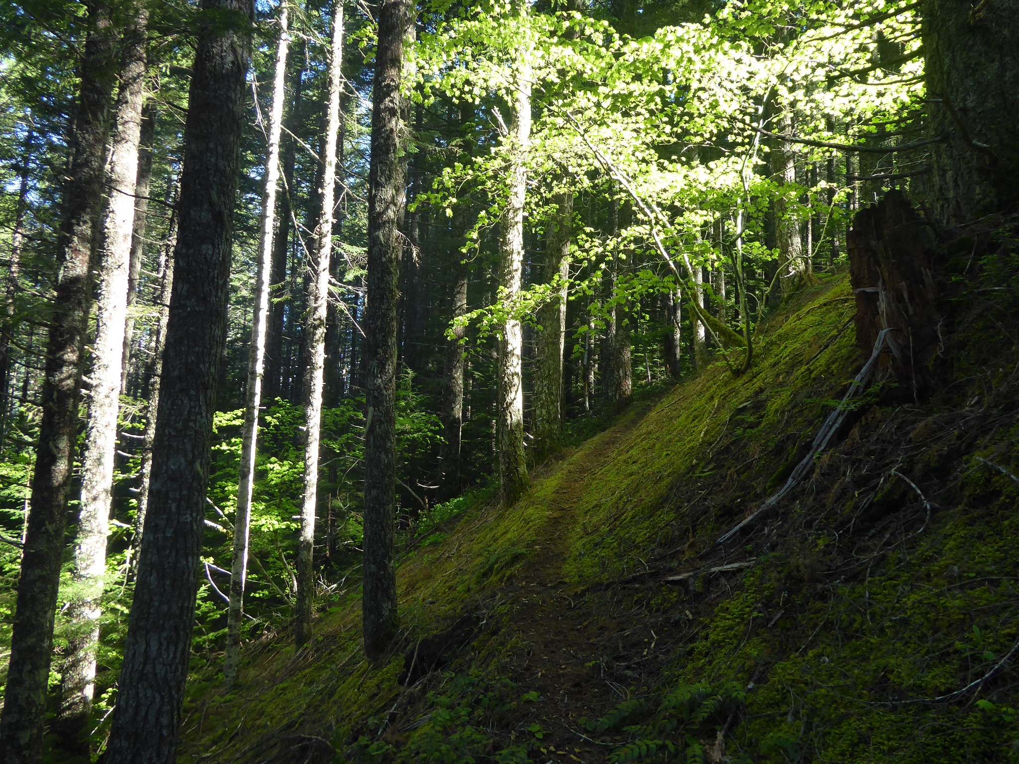
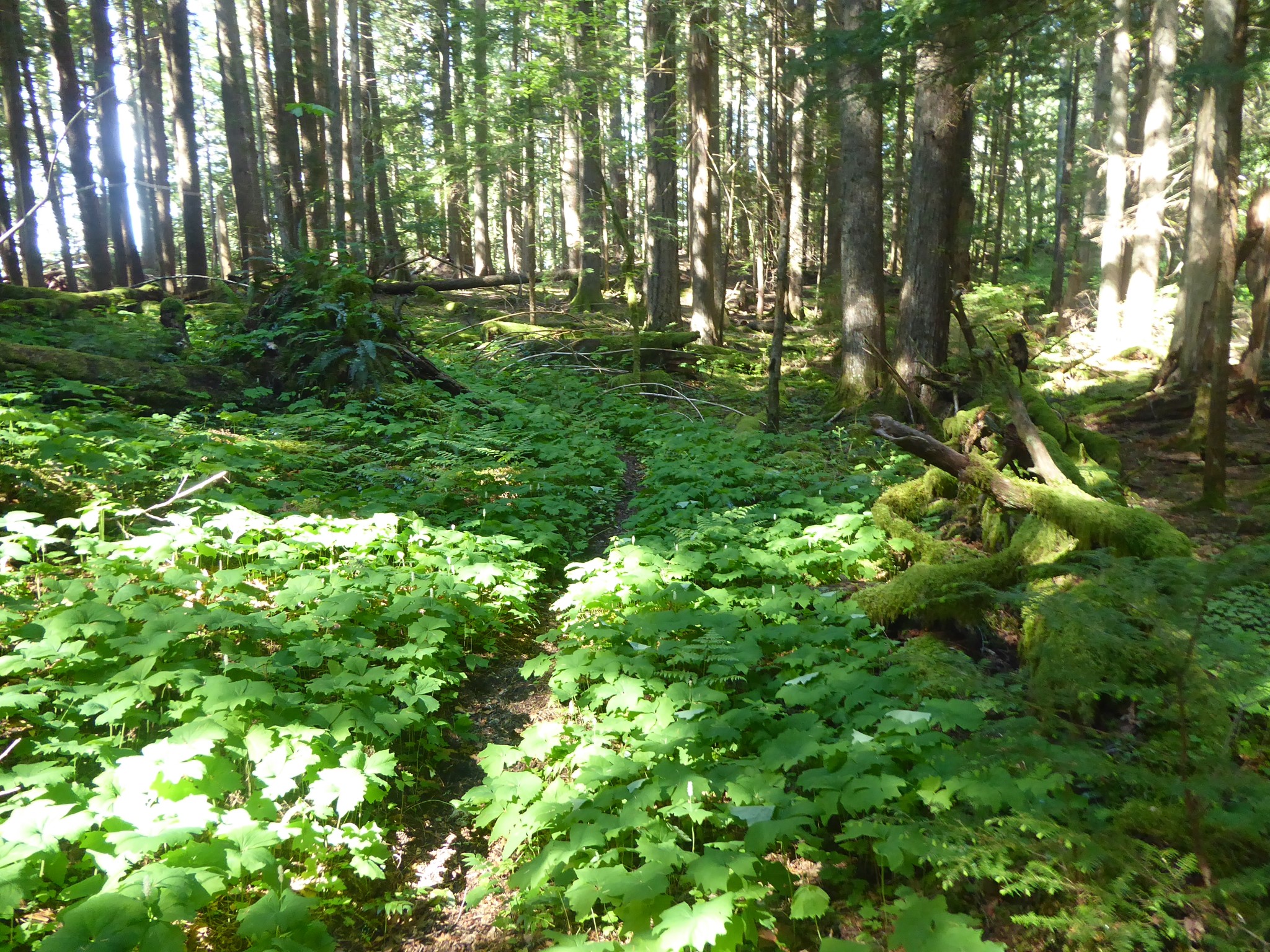
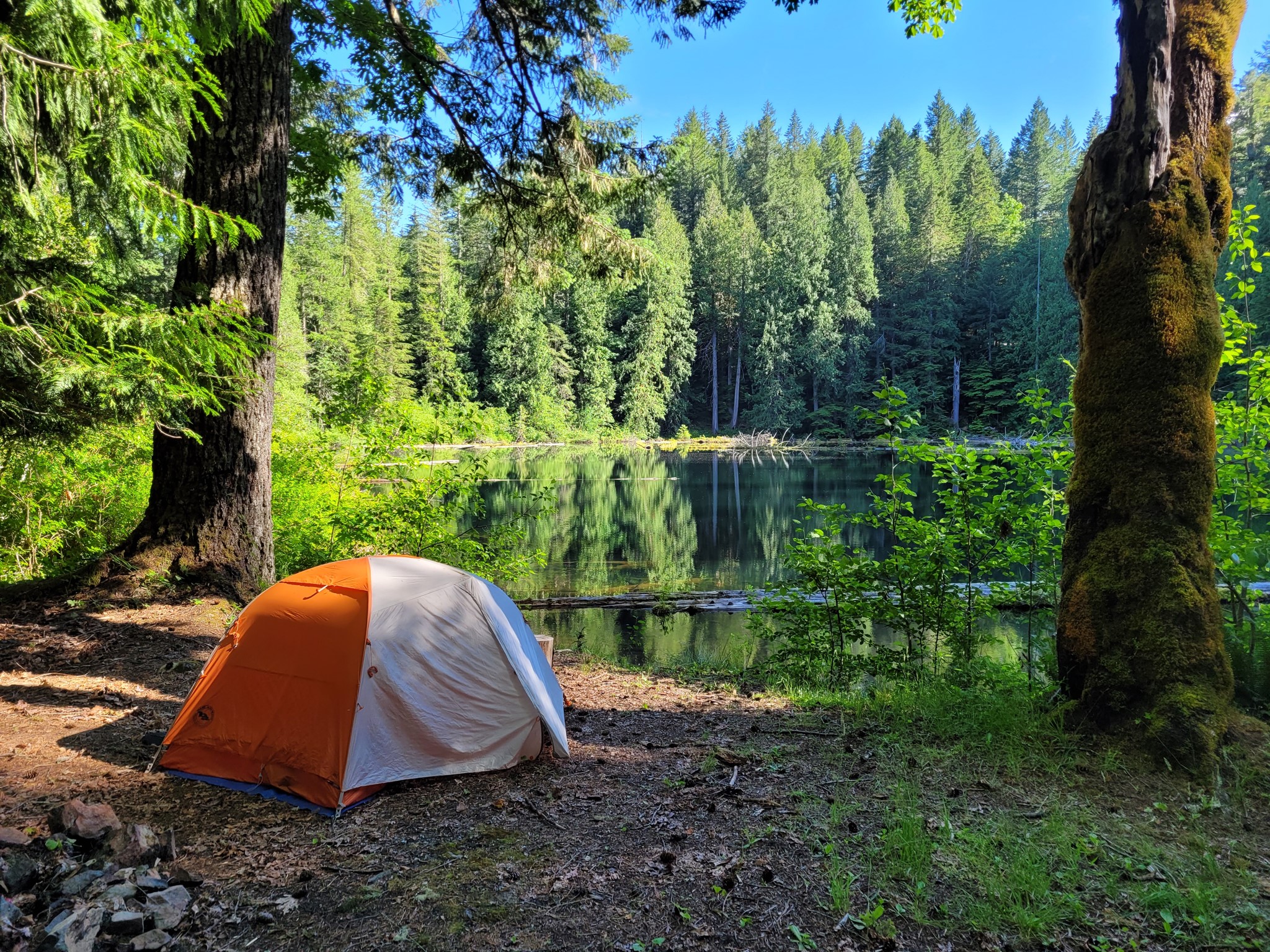
I am pleased to report that the trail not only still exists as of 2021, but is in excellent condition, clearly being hiked on a somewhat regular basis. I found a few sections of overgrown brush (long pants recommended) but never so much that the route was hard to follow. No difficult blowdowns, plus there was recent flagging (orange ribbon tied to trees along the route). Around the far side of Backbone Lake, there's even a well maintained campsite.
In fact the trail was in such good shape that it got me wondering, what about the earlier abandoned upper/north section of Backbone Ridge? I was too tired to explore this, but noticed the start of a path heading that way. Something to investigate another day...
(2024 update: the upper trail kinda still exists)
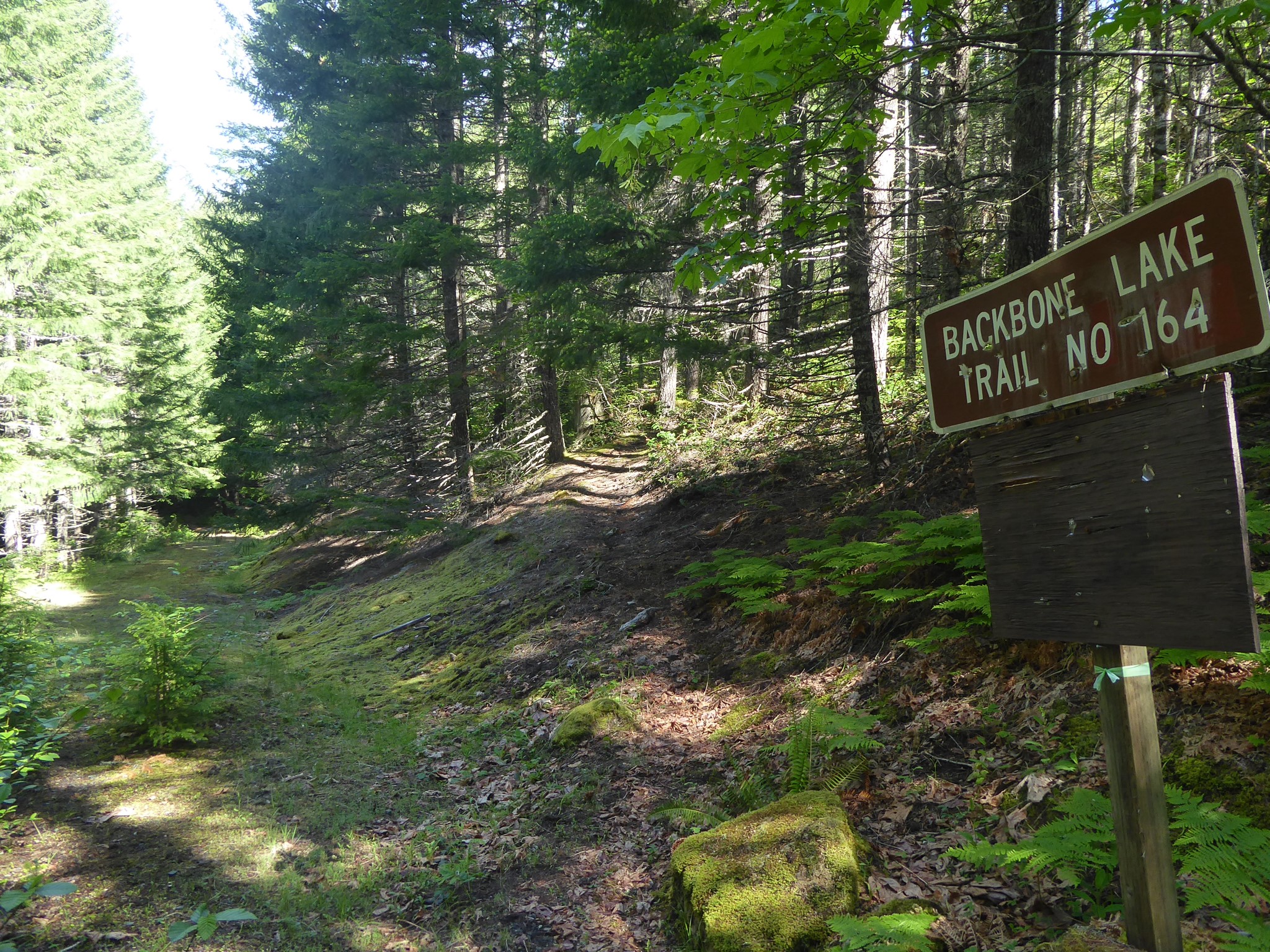
Navigational notes: the trail starts at the southernmost point along Stevens Canyon Road, where the National Park protrudes to the south. Driving from the east, there's a large parking space on the right near the apex of the bend. If you arrive at the viewpoint on the left and see Rainier, you've driven too far. Unmarked trailhead is across the road from the west of the parking space. Only the first few hundred feet of trail are inside the National Park, but that's quite enough to justify its inclusion on this website (even though the entire route lies off the edge of the map I designed the site around :-( Caltopo shows the Backbone Ridge trail on both its main MapBuilder layer and the historic 1915-1945 map layer, in slightly different places. These are both wrong, as the actual trail runs in between the two.
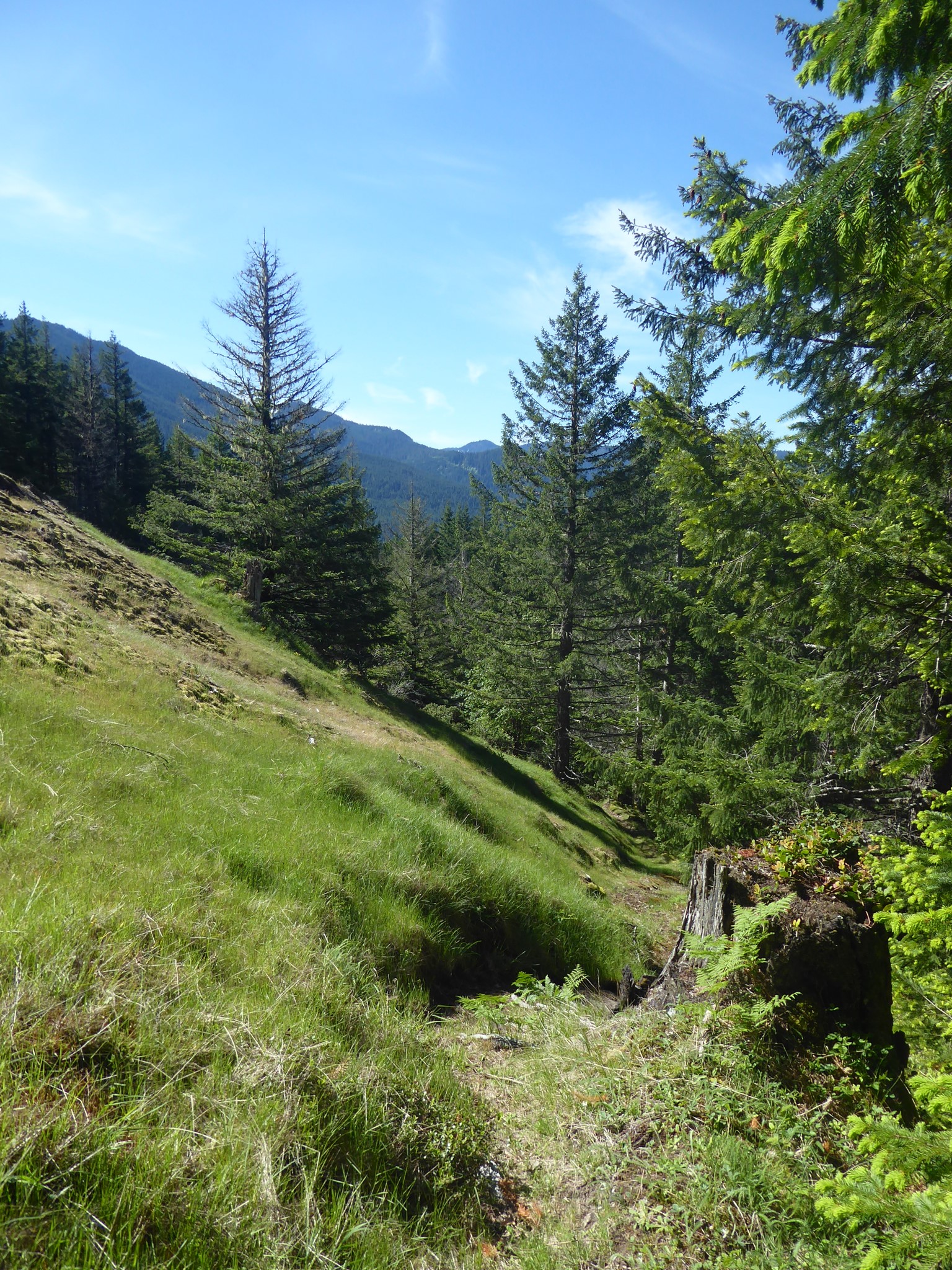
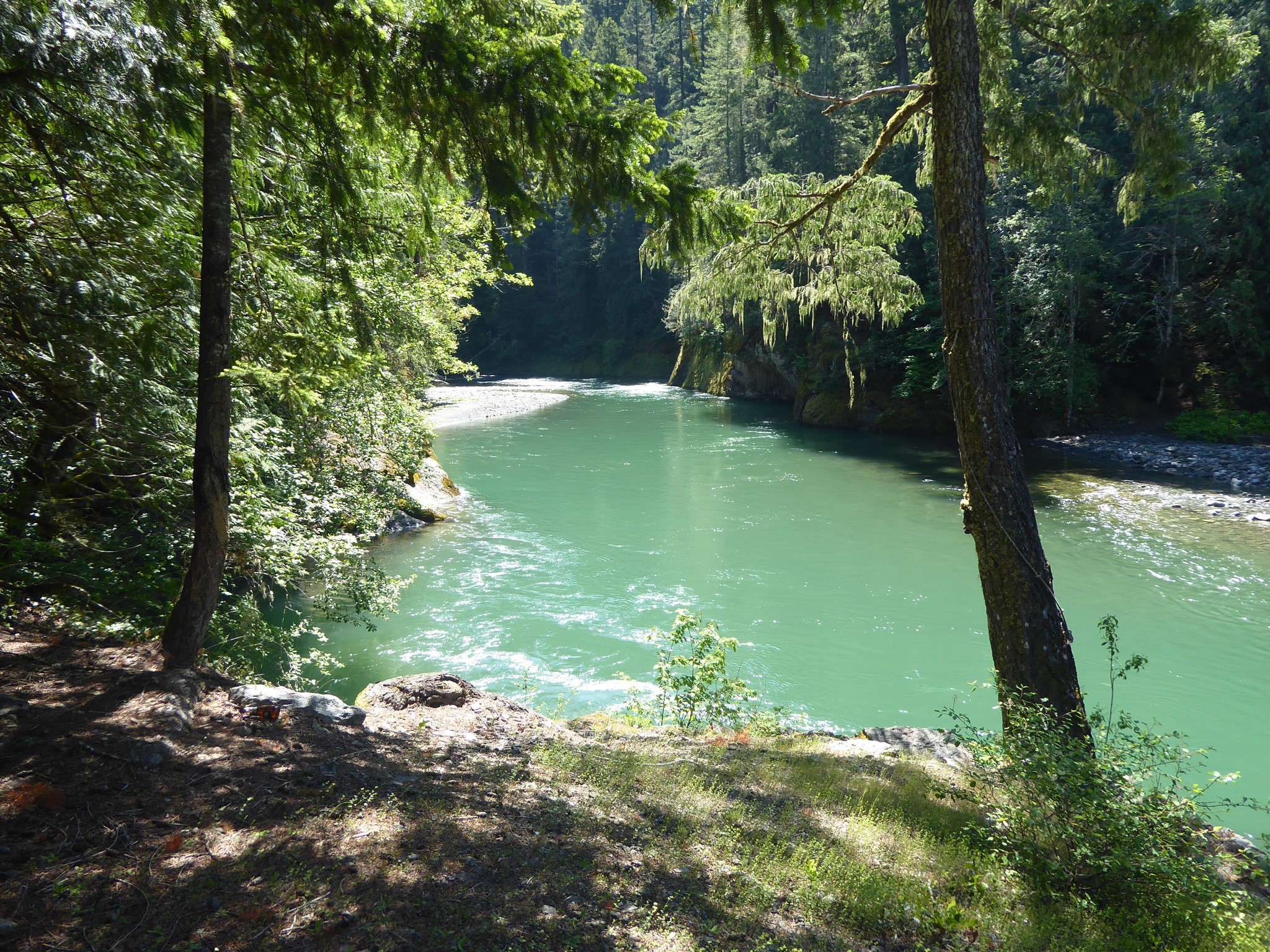
This is a forested ridge hike with no views, although there are several more open sections where you can enjoy the warmth of sun on your skin. Backbone Lake is slightly off the main trail and well worth looping around. Options for a shorter hike would be to turn around at the lake (5.7 miles, 2070' gain) or at what used to be the lower trailhead on Forest Road 1270 (6.6 miles, 2370' gain), but I'm a sucker for abandoned roads in the process of being reclaimed by trees, of which this was a lovely example, so I continued all the way down to the Cowlitz River. That's a strange place. You can see earthworks that once supported the bridge, hear the traffic of nearby US 12, and wave at the car campers on the other side of the river, but there is no way to reach them. I was topologically remote yet physically so close to civilization.
While hiking back up to my car, I was thinking about the Taidnapam people who walked this route so many times before me. Their trail has been superseded by roads that allow easier access to the high places, and is fading from the memory of hikers as it ages off the maps, yet it still exists. This is a strong trail, part of the history of this mountain, and it welcomes those who seek it out. The symbolism is unsubtle.