|
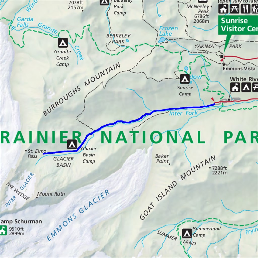
Glacier Basin Difficulty: moderate 8.5 miles Elevation gain: 2380' Max elevation: 6650' Camps: White River, Glacier Basin First hiked by me: older |
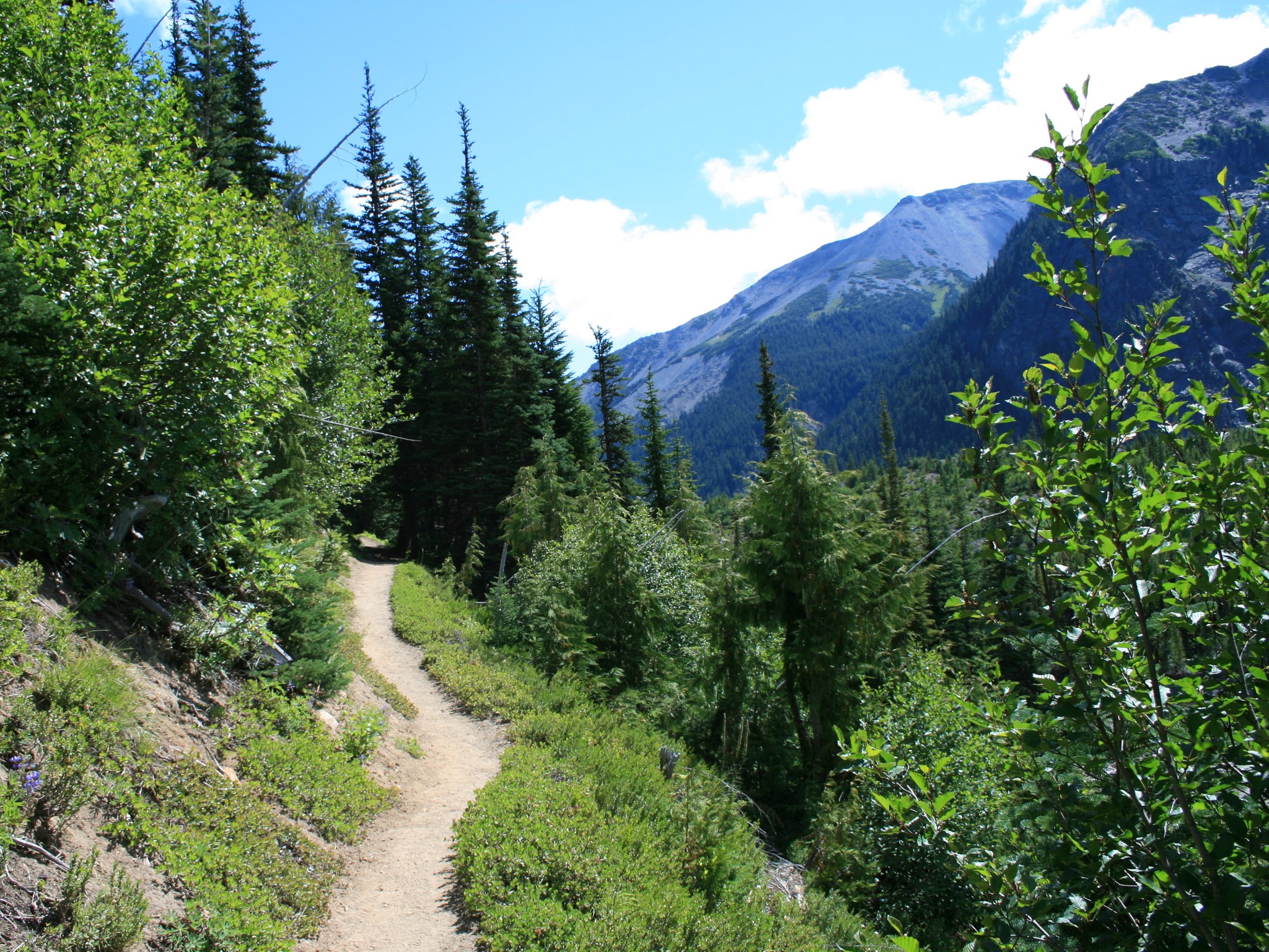
This hike is reported elsewhere as being significantly shorter than the numbers I'm giving above. Usually more like 6 miles with 1600' elevation gain. That's what happens if you start at the White River campsite, hike up alongside the Inter Fork of the White River, and turn around at the 'End of Maintained Trail' sign by the Glacier Basin backcountry camp. It's a pleasant enough hike, through varied forest with occasional more open views, and the high basin at the end of the trail is quite beautiful.
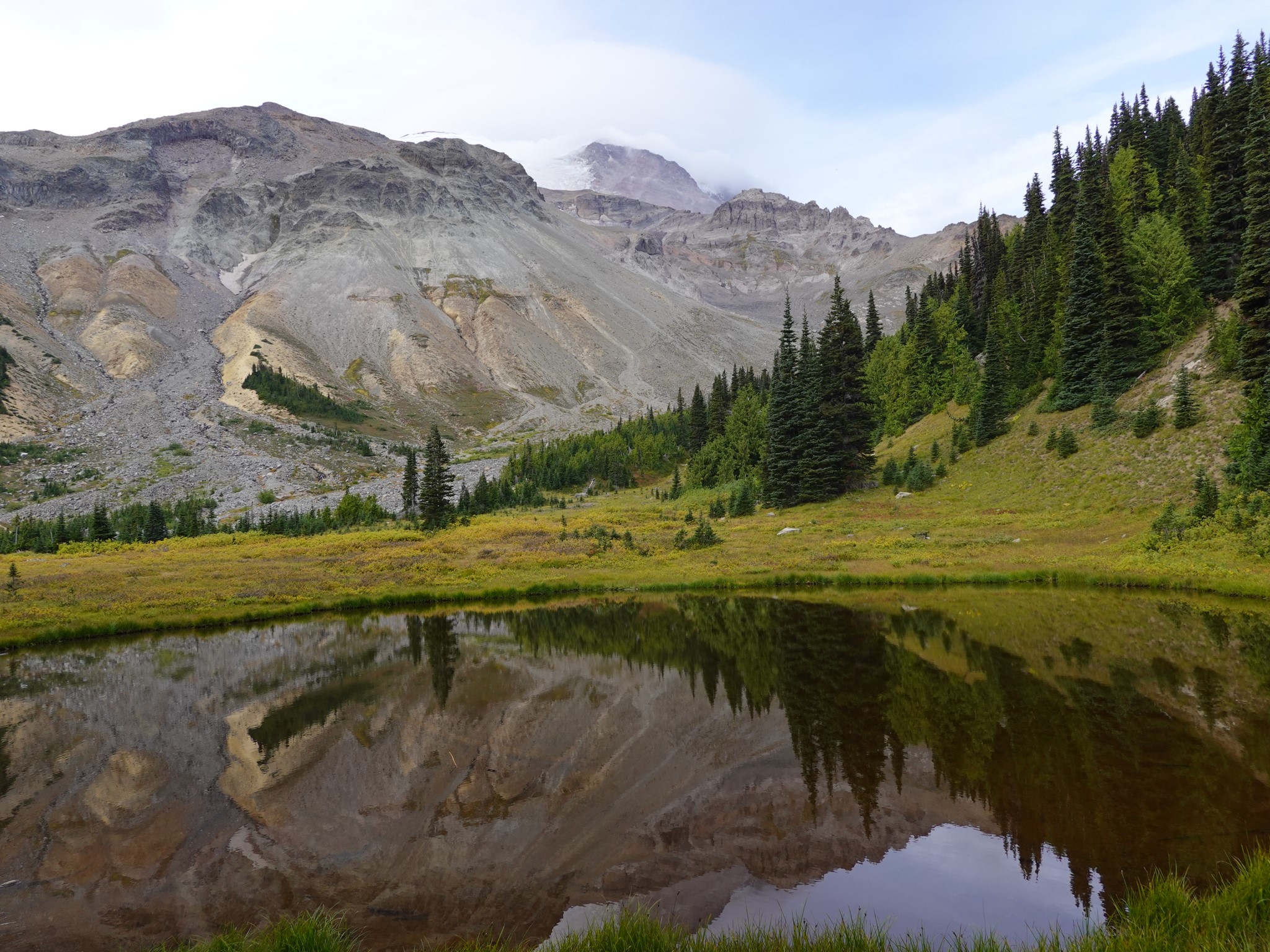
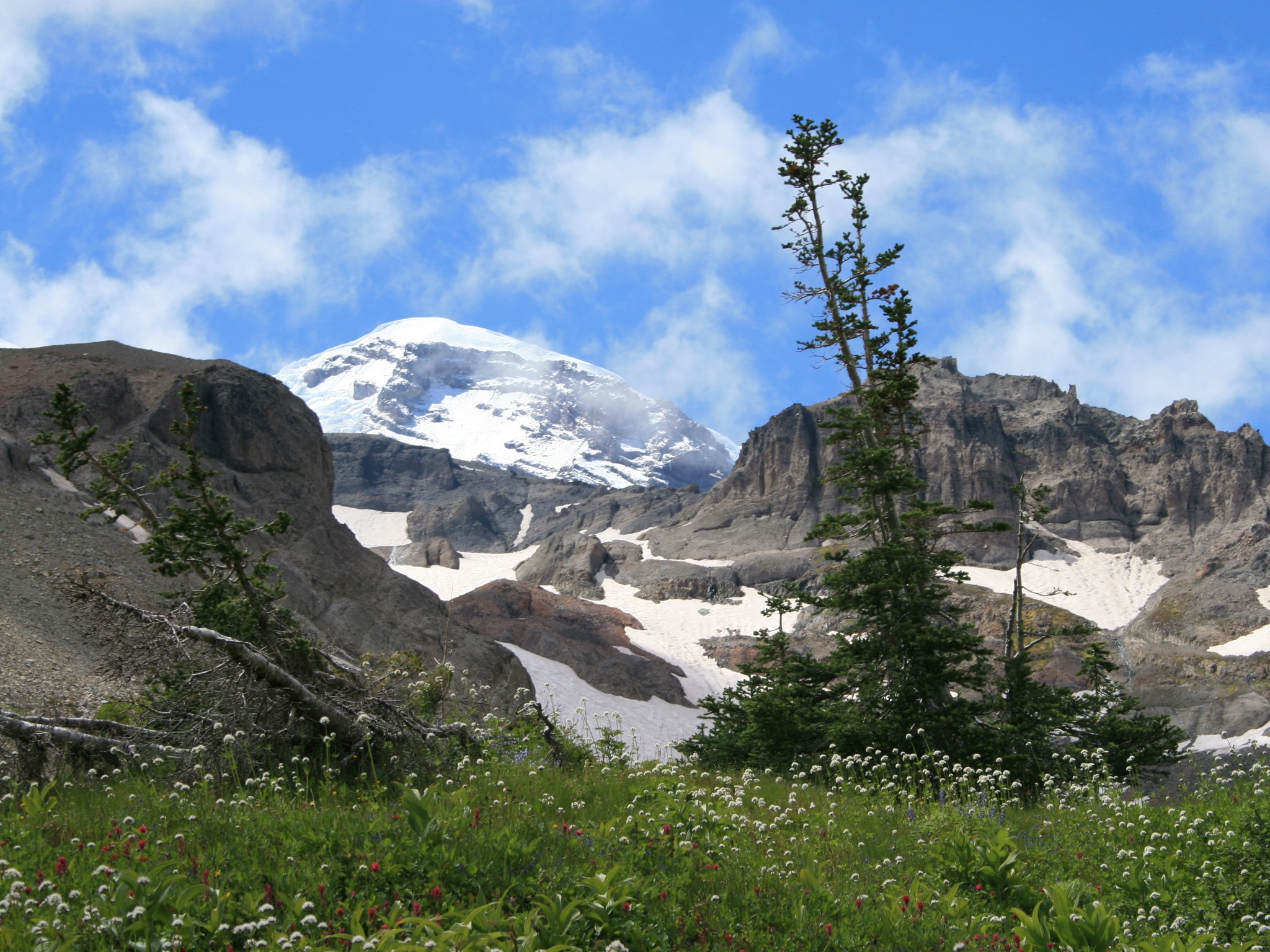
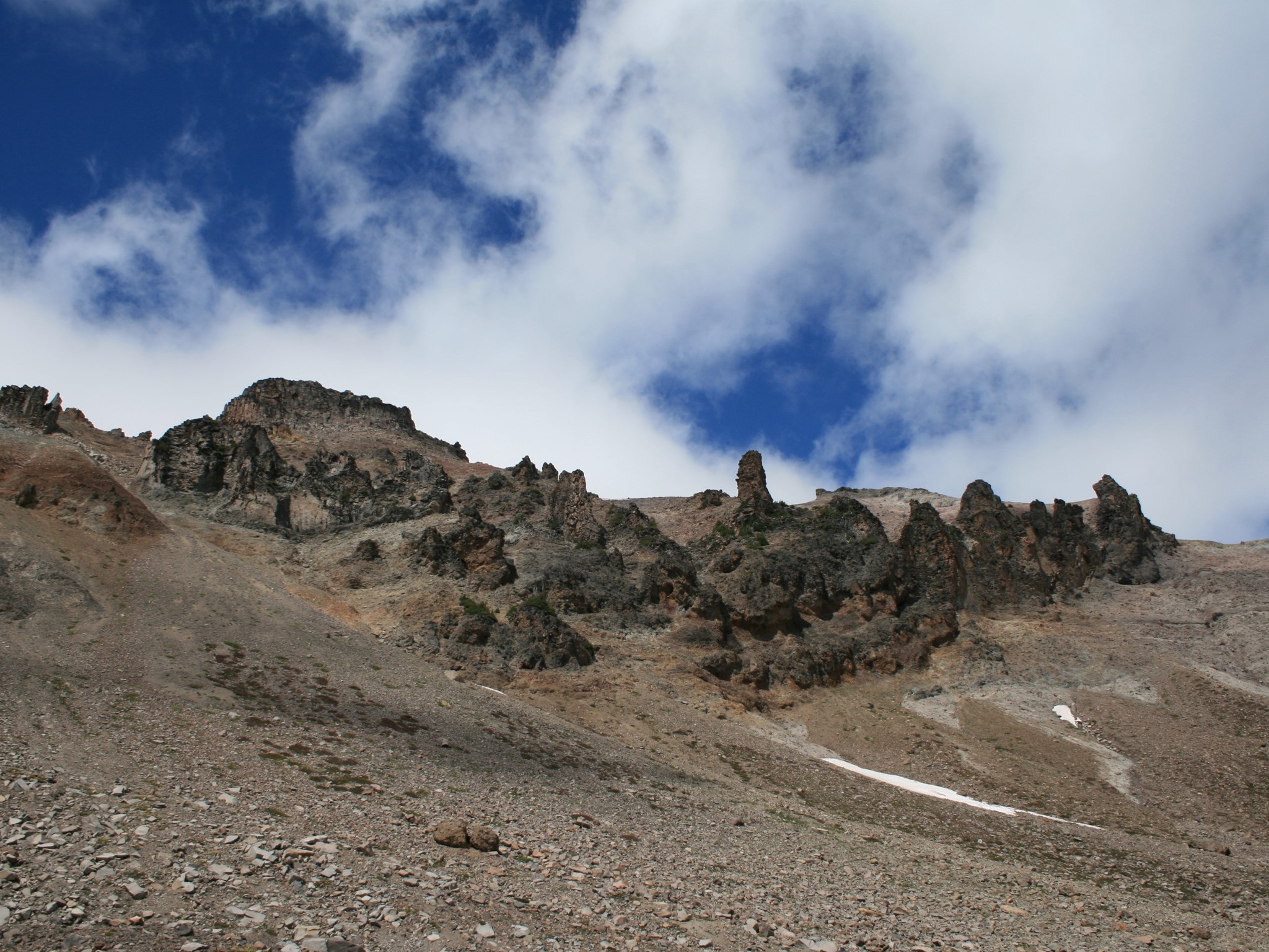
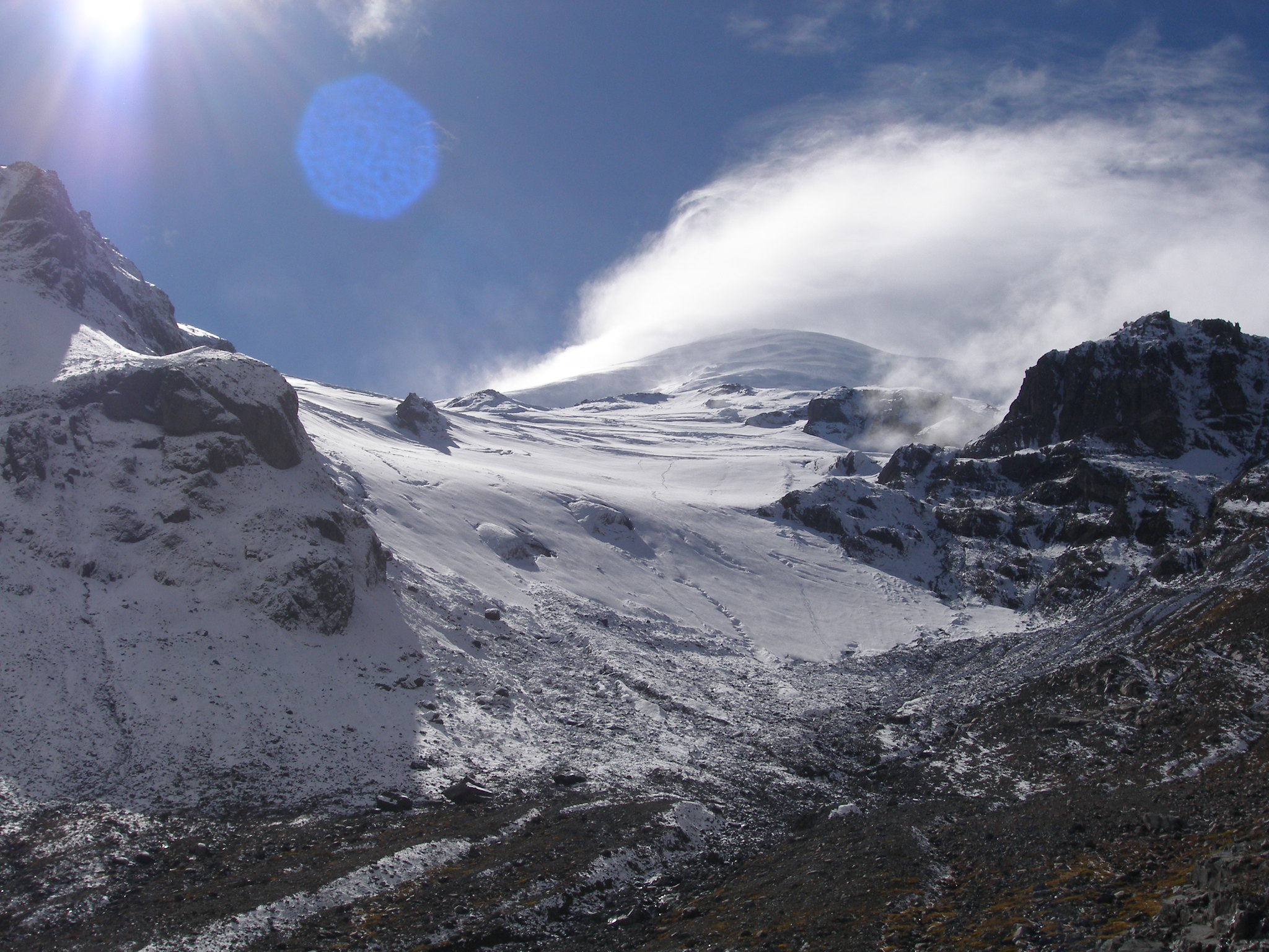
You're really missing the point if this is all you do here, though. Far greater rewards are to be had by going further. After you reach the end of the official trail at the entrance to Glacier Basin, an unofficial but easy to follow climber's path continues upward through the basin. It passes a small moraine on its way to the foot of the Inter Glacier, at which point it becomes a summit climbing route requiring special equipment and skills. Don't venture onto the glacier if you lack these, but do continue up the basin as far as you want. It's super cool.
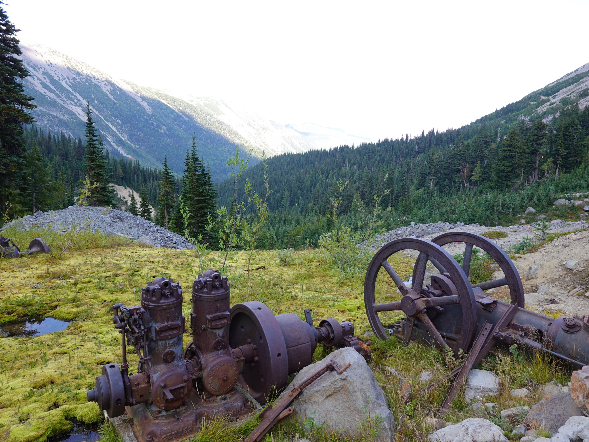
Many copper mining claims were registered here in the 1890s, and Peter Storbo incorporated the Mount Rainier Mining Company in 1904. Despite ongoing disagreements with the park that led to surrendering 32 of their 41 claims, by 1920 they had dug several tunnels and constructed buildings including a barn, power plant, sawmill, and hotel. The current Glacier Basin trail owes its width in places to a rough road built by these miners, but the mine never became profitable due to the short working season, high cost of maintaining the access road, and most importantly, lack of enough copper to be dug. After the company continued to raise funds from shareholders via increasingly implausible claims, Storbo was imprisoned for fraud in 1930, and the last remnants of the mine were bought out by the government in 1984. The full story is told in Mining Glacier Basin.
The Glacier Basin trail also forms part of the Emmons Moraine trail and Glacier Basin / Burroughs Loop.