|
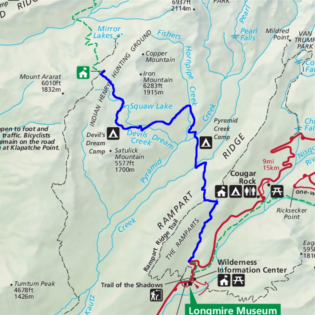
Indian Henry's from Longmire Difficulty: strenuous 12 miles Elevation gain: 3420' Max elevation: 5370' Camps: Pyramid Creek, Devil's Dream First hiked by me: older |
For me at least, Indian Henry's Hunting Grounds is a place of romance and mystery.
It's on the remote west side of Mount Rainier, which is largely accessible only to backpackers. This is one of the few reasonable day hike destinations between Longmire and Mowich Lake.
It's also the first segment of the Wonderland Trail to be experienced by many backpackers, as clockwise-starting-at-Longmire is the most popular Wonderland itinerary. I find it impossible to hike this trail without imagining the countless Wonderland adventures that have started here. At the first serious uphill I think of all the backpackers who perhaps found themselves here wondering, did I really need to bring that extra foldable camp chair? :-)
And then there's the history. The destination of this hike is named after a Taidnapam/Yakama farmer and guide named Satulick who spanned two worlds, combining traditional hunting and fishing customs with the ways of the settlers who called him Indian Henry. His real name was alternatively spelled So-to-lick, Soo-too-lick, or Sotolick. He was born near Yakima in 1825 and moved to the Mashel Prairie outside Eatonville in 1864, where he prospered as a farmer and provided travelers with lodging and supplies. He guided early climbing parties including those of John Muir, James Longmire, and Philemon van Trump. He went on frequent expeditions to the high meadows of the Hunting Grounds, and there were rumors that he had a secret gold mine in the area. No sign of it has ever been found though.
Petition: can we please rename this place to something more respectful, perhaps Satulick's Hunting Grounds?
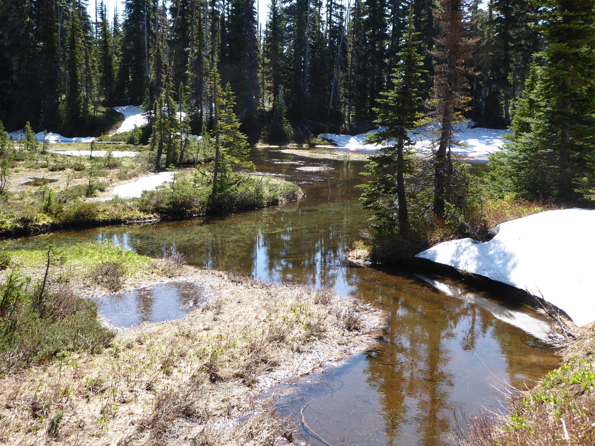
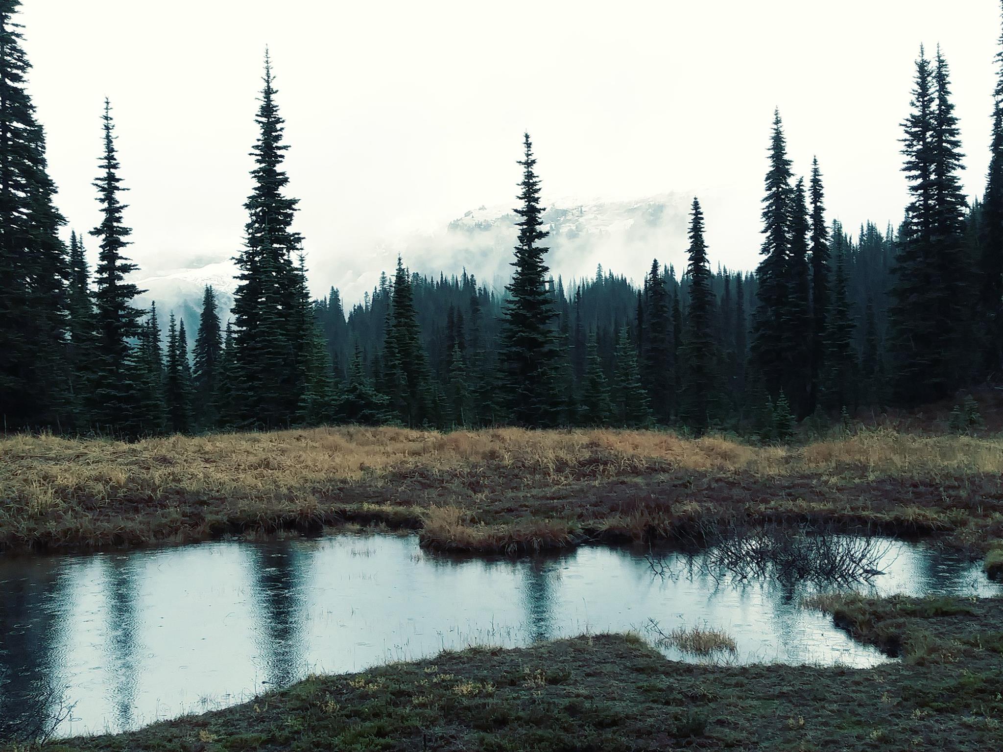
Kiya Lake used to be named after a racist label for Native women (Sq___ Lake) due to a story that So-to-lick's wives would rest near it while he hunted in the meadows above. But who in their right mind would choose to hang out there? It's pretty and all, but SO many mosquitos! The lake was renamed to Kiya, which means 'grandmother' in the Lushootseed language of the Puget Sound Salish, in 2022 after the Department of the Interior declared Sq___ a derogatory term.
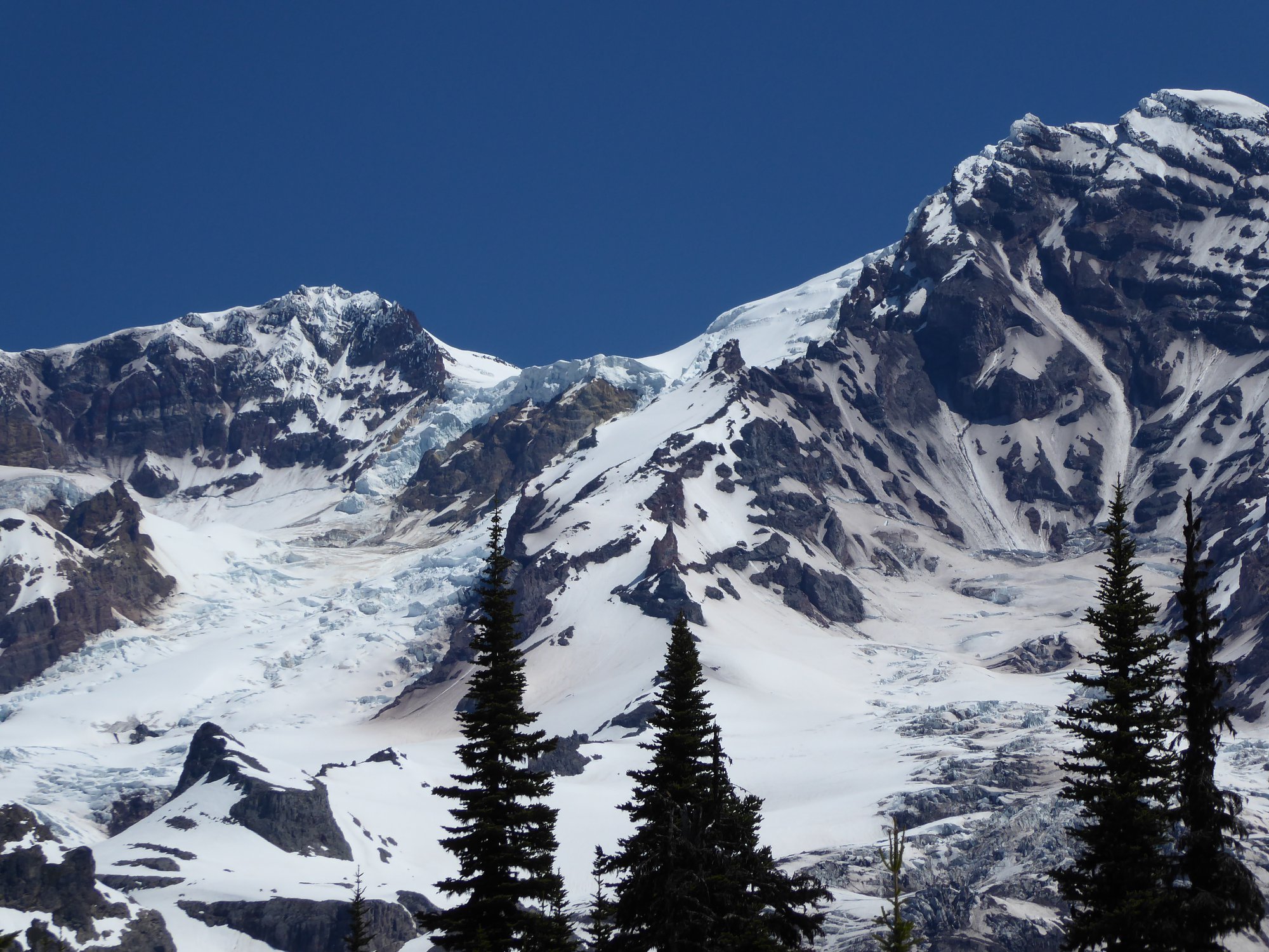
The hunting grounds lie below Mount Ararat, which was named by Ben Longmire (grandson of pioneer James Longmire, and original builder of many Rainier trails). Ben found a petrified tree stump with what looked like rope marks around it in the middle of a field of debris, and romantically fancied that this might be where Noah's Ark had first tied up after the flood.
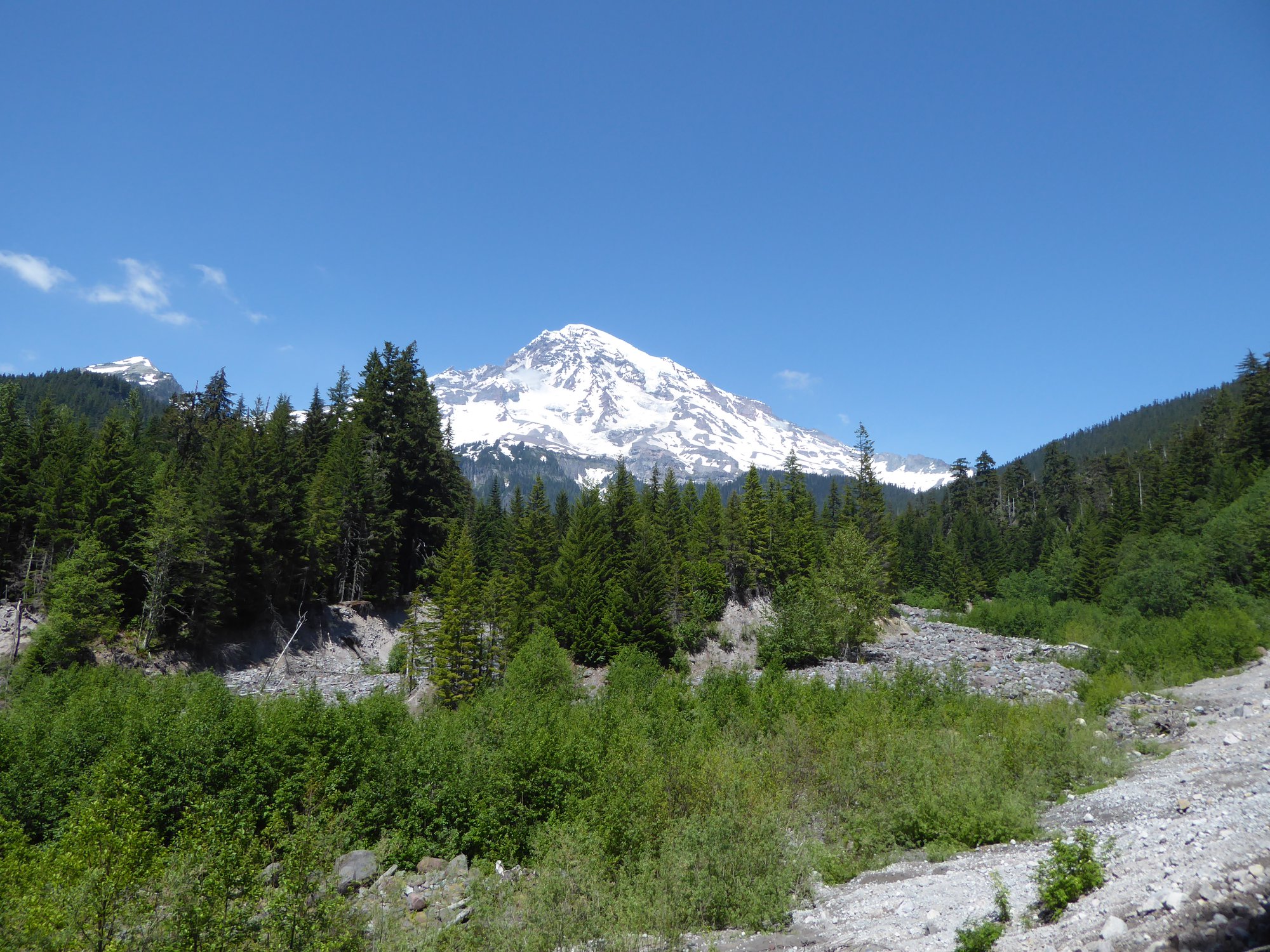
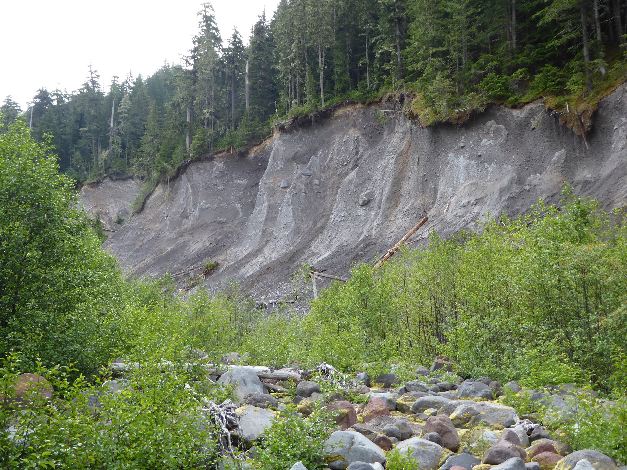
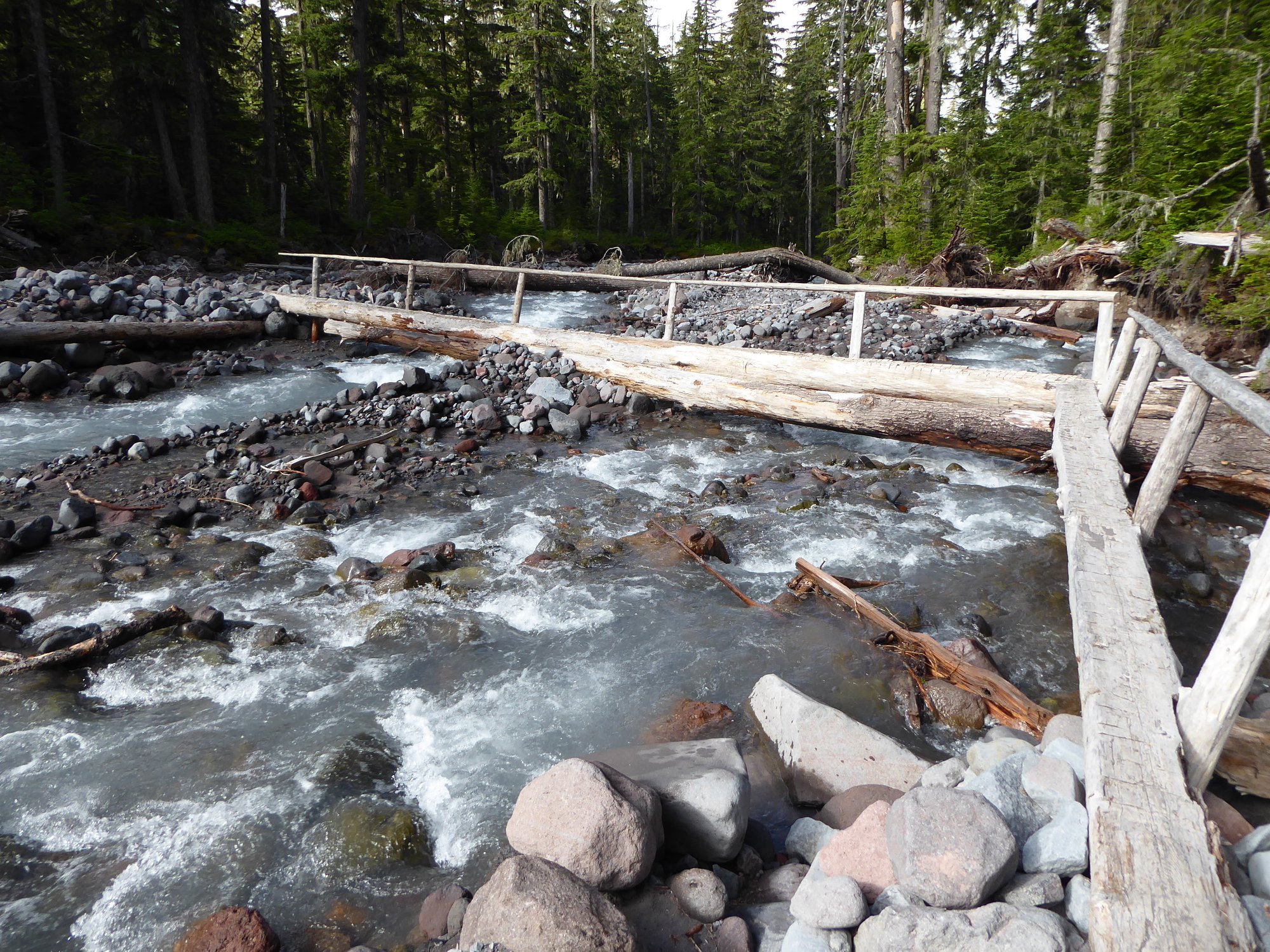
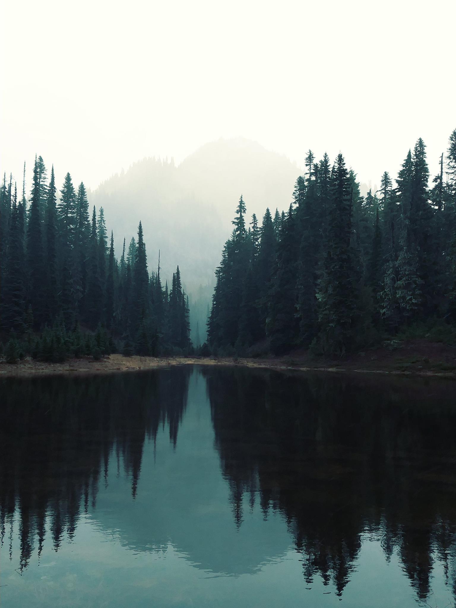
Anyways. The trail starts at Longmire: park in the lot to the right of the road shortly after the main Longmire complex. Cross the road, and head north along the forested Wonderland Trail signposted Pyramid Creek and Devils Dream (ah, the romance of these names). Climb up to Rampart Ridge, ignoring the Van Trump trail turnoff on the right and Rampart Ridge trail on the left. Descend to the Kautz Creek valley, which (at least each time I've been here) contains a small trickle of water in the middle of a giant swathe of destruction that testifies to how not-small it can become when in the right mood. Follow cairns to find your way across the valley floor, then pass Pyramid Creek Camp and use the log bridges to cross Pyramid Creek. Now comes a serious climb, switchbacking up through forest, crossing Hornpipe Creek, switchbacking up some more through different forest, and eventually arriving at Devils Dream Camp, which turns out to be just a few flat spaces to pitch tents in the middle of the forest.
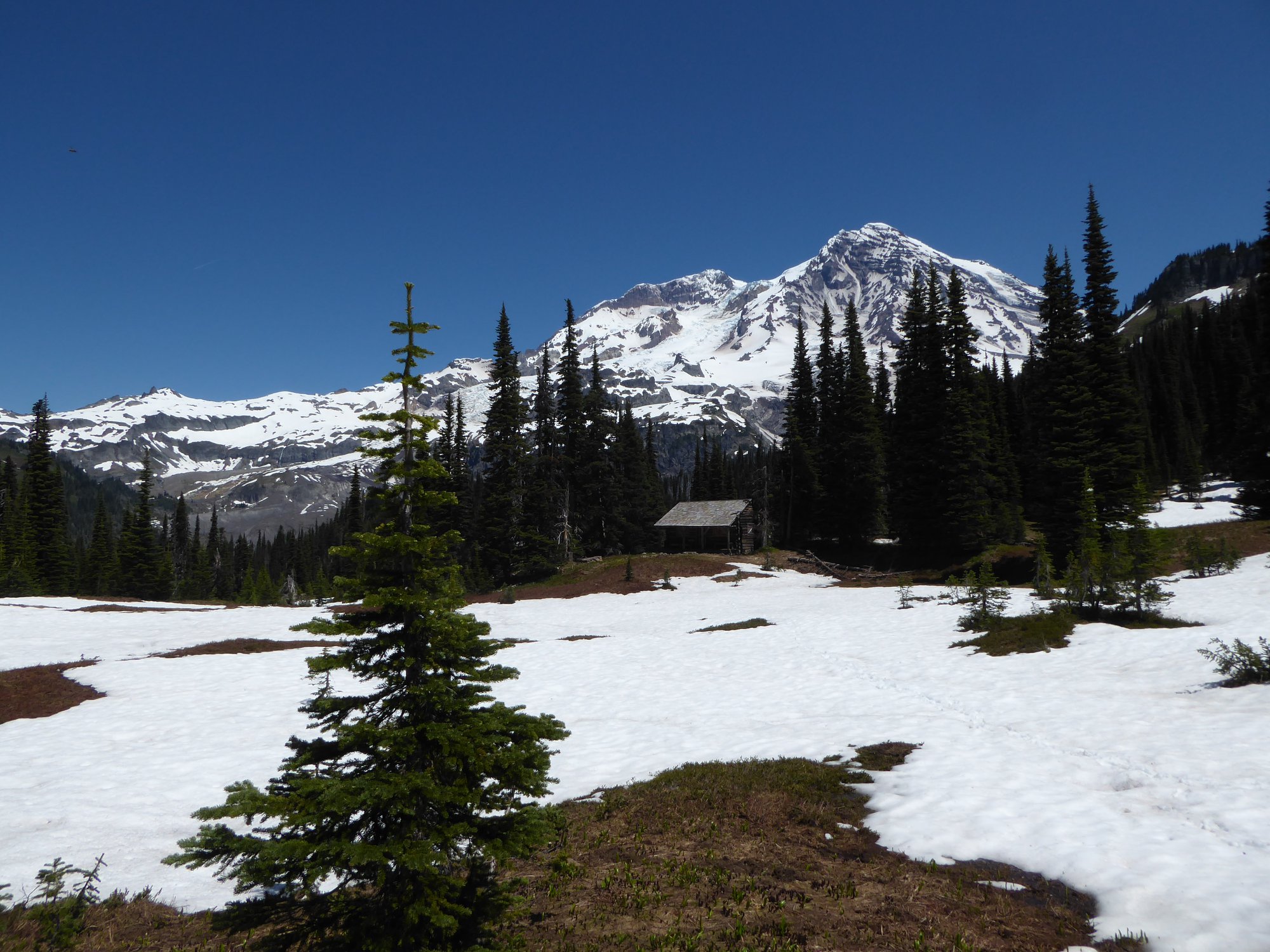
Shortly past the camp, views start to open up at Kiya Lake, which is a lovely area of trees and water and frogs. A little more climbing and you arrive at Indian Henry's Hunting Grounds. This is an open meadow containing a historic patrol cabin, framed in front of a Rainier perspective that you just can't get anywhere else. The cabin was built in 1915, and all these years later the porch is still a great place to eat lunch when it's raining.
If you have any gumption left, continue 0.2 miles to a turnoff on the right, which is a 0.5 mile spur to the photogenic Mirror Lakes.
Indian Henry's Hunting Grounds can also be reached via Indian Henry's from Kautz Creek.