|
Summerland and Panhandle Gap Difficulty: strenuous 11 miles Elevation gain: 3060' Max elevation: 6785' Camps: Summerland First hiked by me: older |
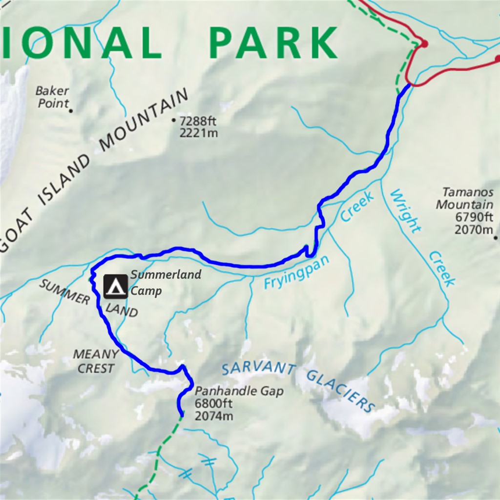
The section of Wonderland Trail from Fryingpan Creek to Summerland and then on to Panhandle Gap is among its finest. This is also accessible as a day hike, so the distance shown here is roundtrip. Turning around at Summerland would cut out 2.7 miles and 950' of elevation, but miss the best part of the trail.
Parking space at Fryingpan Creek is limited, so it's a good idea to arrive early.
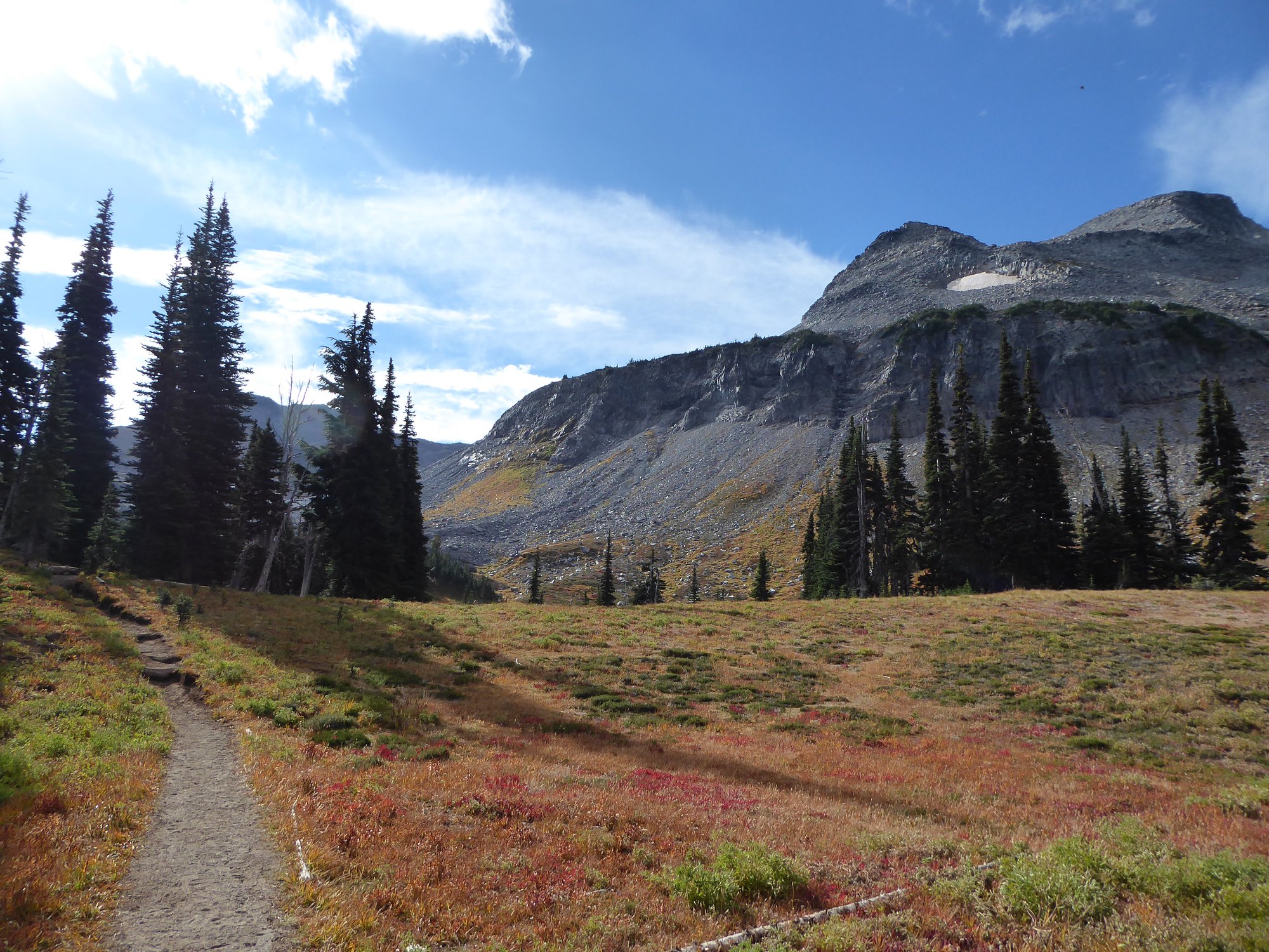
The trail sets out through a grand old forest, following alongside and with occasional glimpses of Fryingpan Creek. After 3.2 miles it crosses the river and the terrain starts to open up with patches of meadow and partial views. One mile and a handful of switchbacks later, you arrive at the famous Summerland backcountry camp.
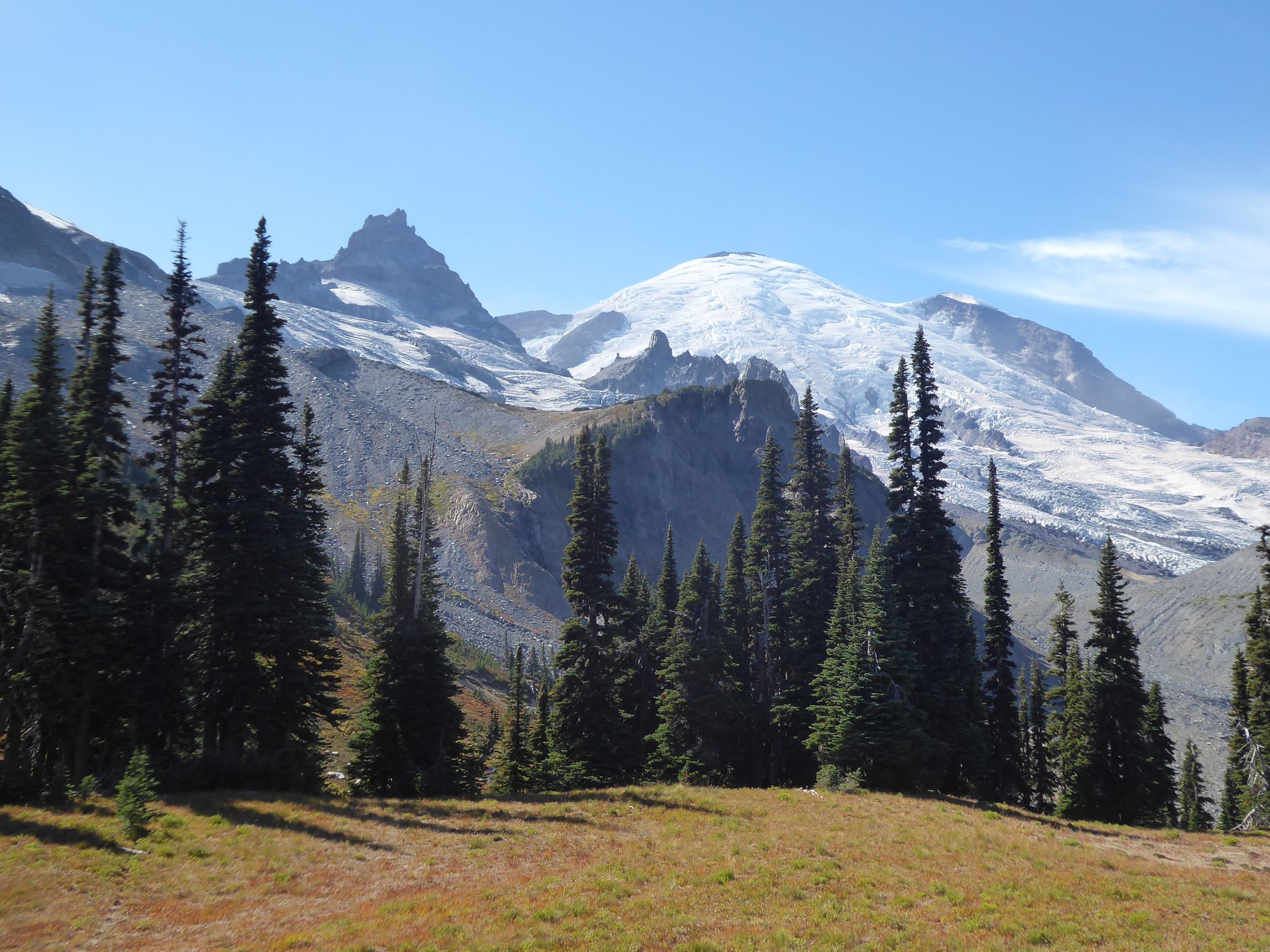
Summerland is a gorgeous alpine meadow. It offers grand views upward to the mountain, downward and outward over distant foothills, and close-up views of happily chattering streams plus of course the obligatory wildflowers. A most excellent place to stop, rest, eat, meditate, nap, pray, or whatever else works for you. Also a fine place to turn around if you are done for the day.
For backpackers, Summerland is one of the most developed campsites along the Wonderland. The group shelter is an actual stone building (built by the Civilian Conservation Corps during the Great Depression), while the toilet is an actual covered outhouse!
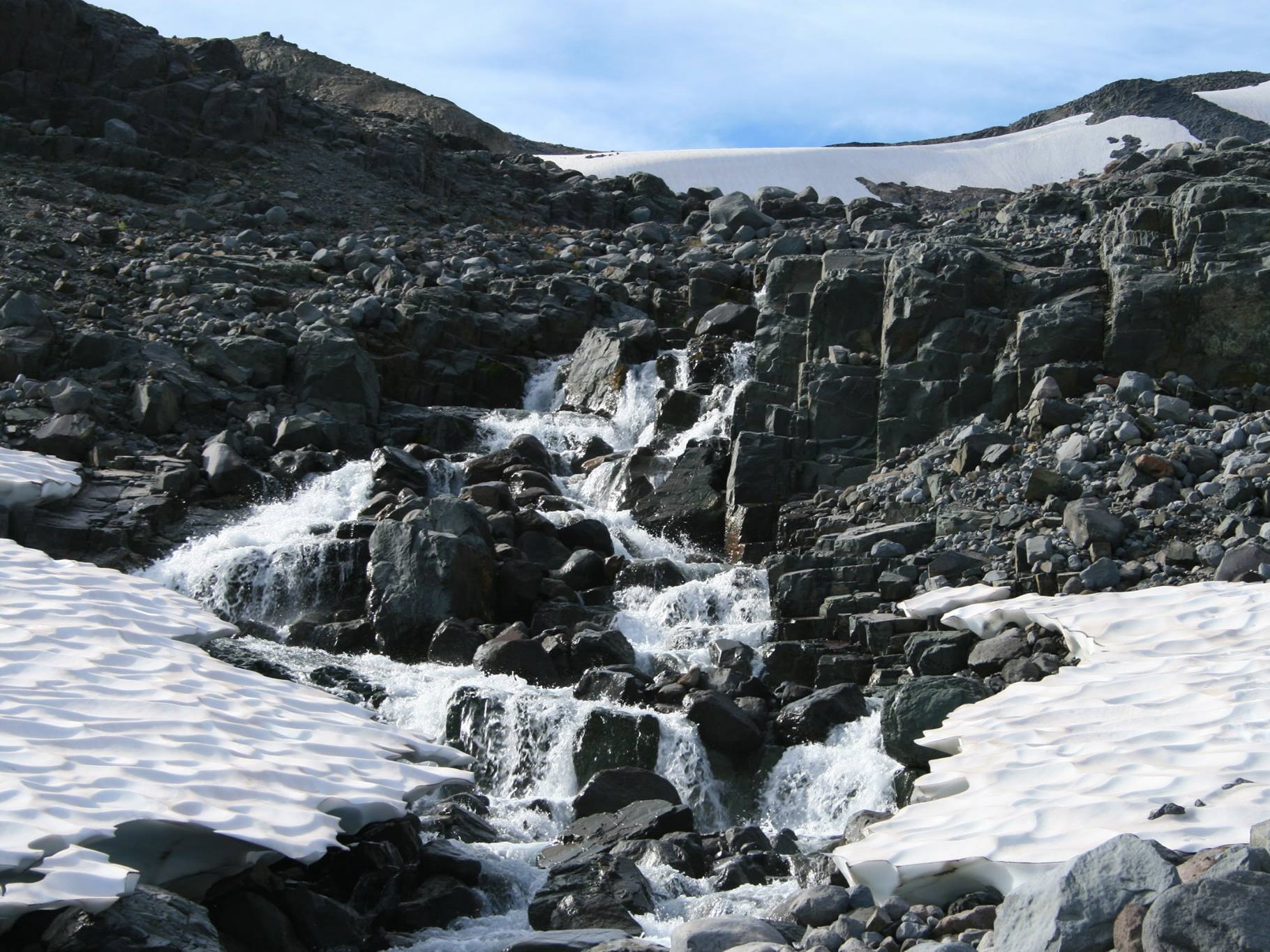
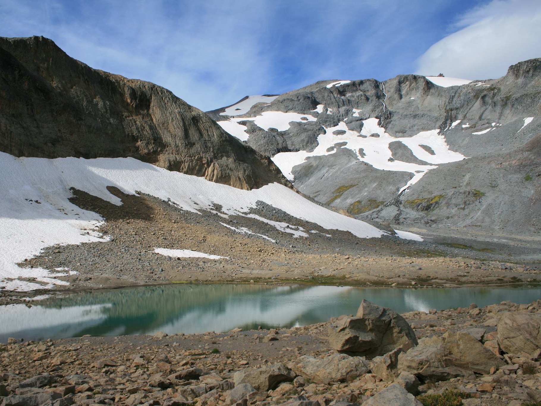
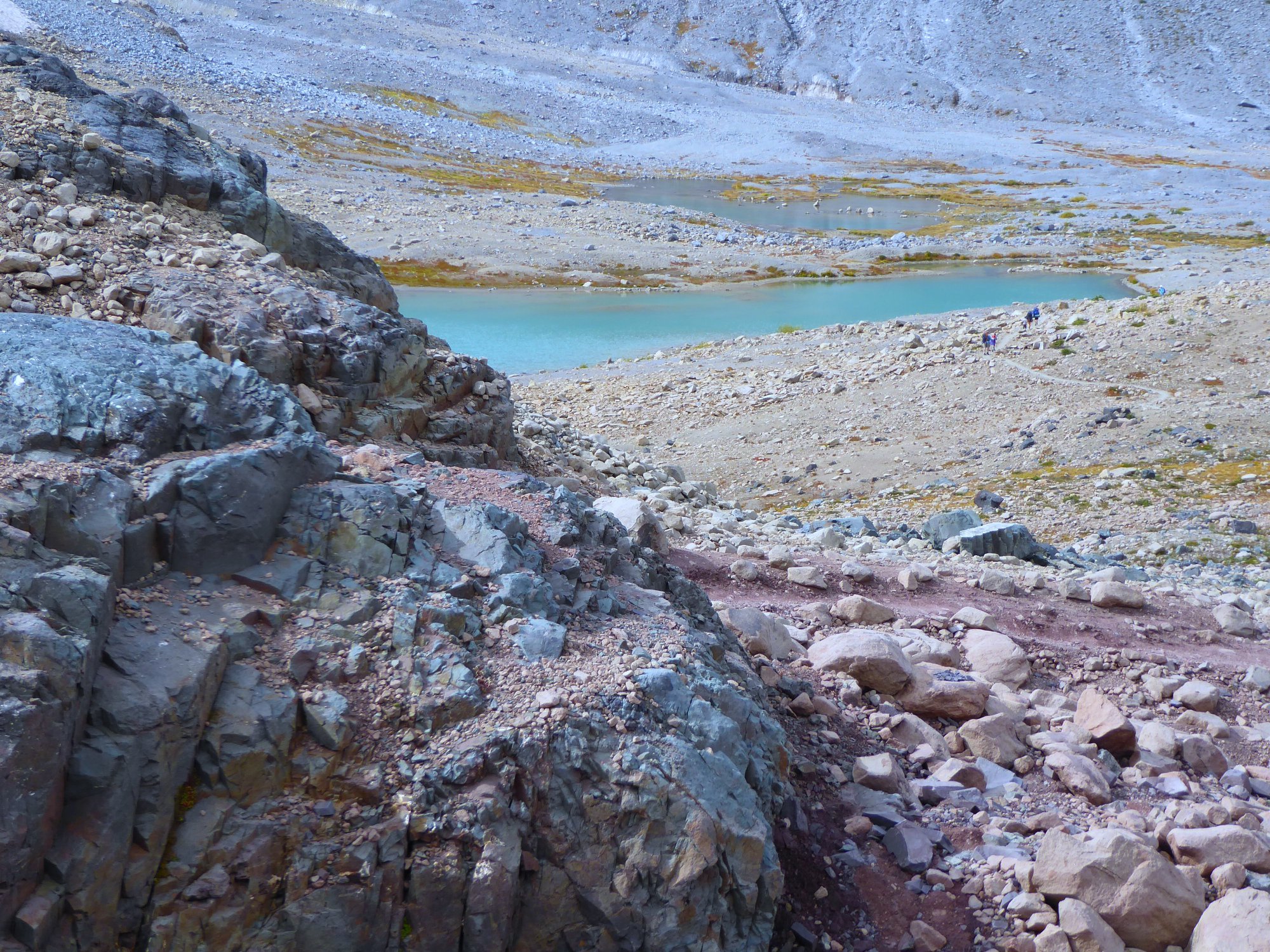
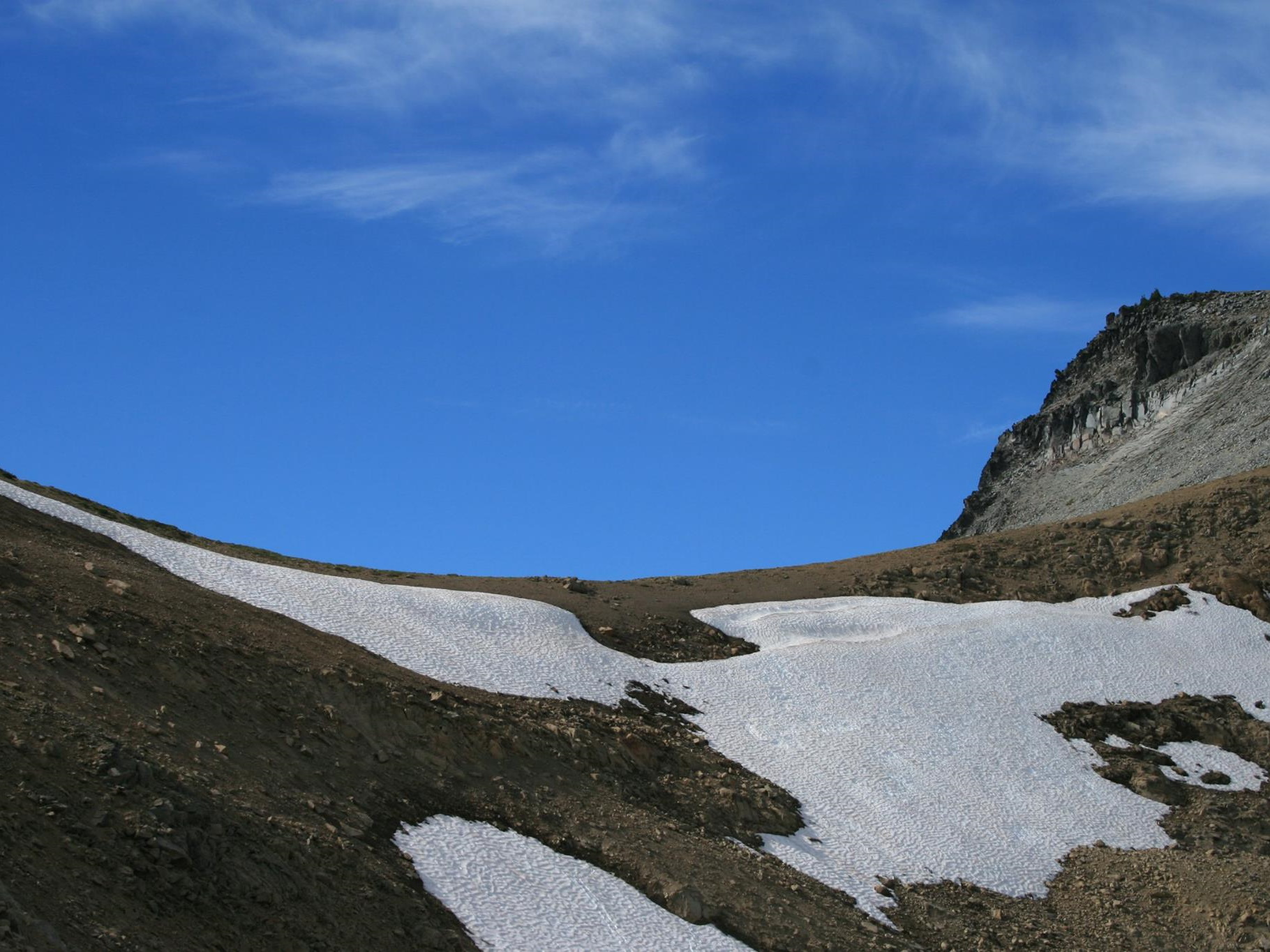
The final stretch of trail from Summerland to Panhandle Gap is where this hike elevates itself from good into the realm of the truly magical. Vegetation dwindles as you ascend into a land of nothing but rock and water and strangeness. Snow patches linger through the summer, and can cover parts of the trail as late as August. Water falls down the cliffs above you, bounds over rocks in the form of countless streams, and fills turquoise meltwater pools. Some of the rocks are tinted pink and blue, to the point where they almost appear to be glowing. Other rocks are assembled into cairns, which are helpful for staying on the sometimes faint trail. Beware navigation if you're up here during bad weather!
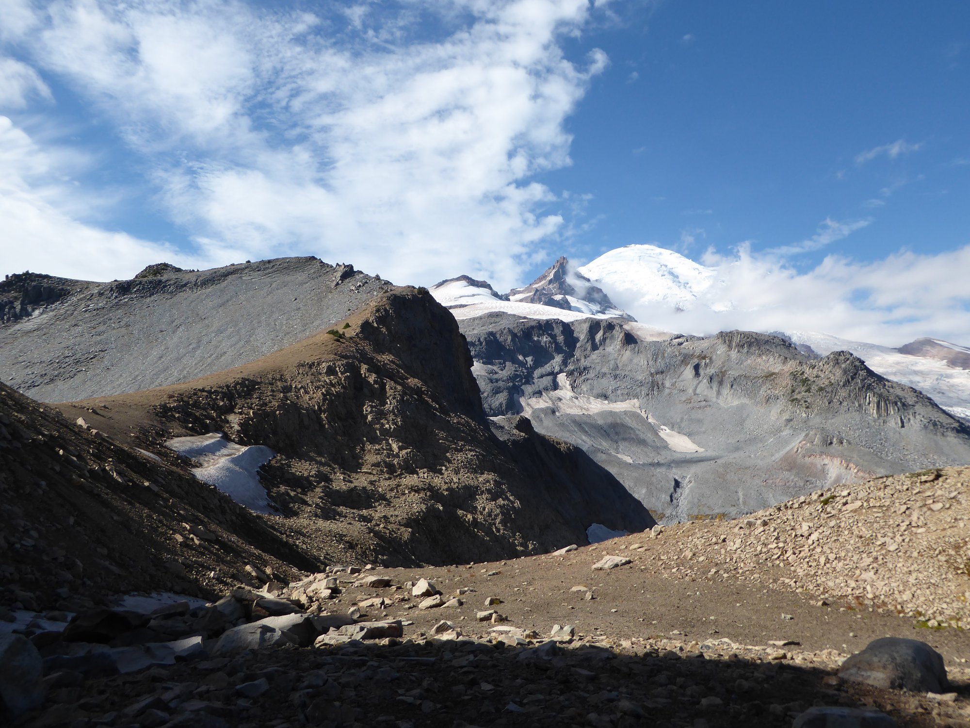
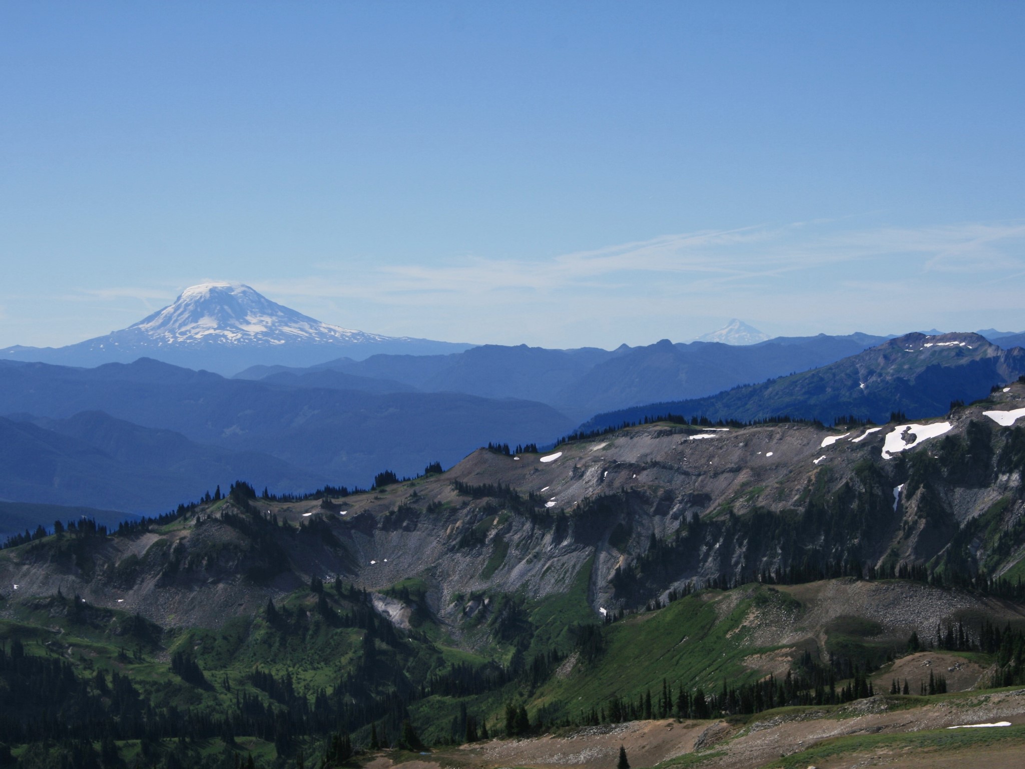
Panhandle Gap is the top of the hike, and also the highest point on the entire Wonderland Trail. Immediately before it comes a short traverse across a steep snowfield, still unmelted in September the last time I visited, where good footwear, hiking poles, and balance come in handy. Immediately after reaching it comes a massive exhalation of breath, as you take in the gloriously expansive view that has opened up before you.
For the few hardy souls who are still not done, the trail descends through the splendid Ohanapecosh Park, at first gently and then more steeply, arriving at Indian Bar 3 miles later and 2000' lower. Combining both of these sections, a through-hike from Fryingpan Creek to Box Canyon is 15.5 miles with 4600' of climbing and 5400' descent.