|
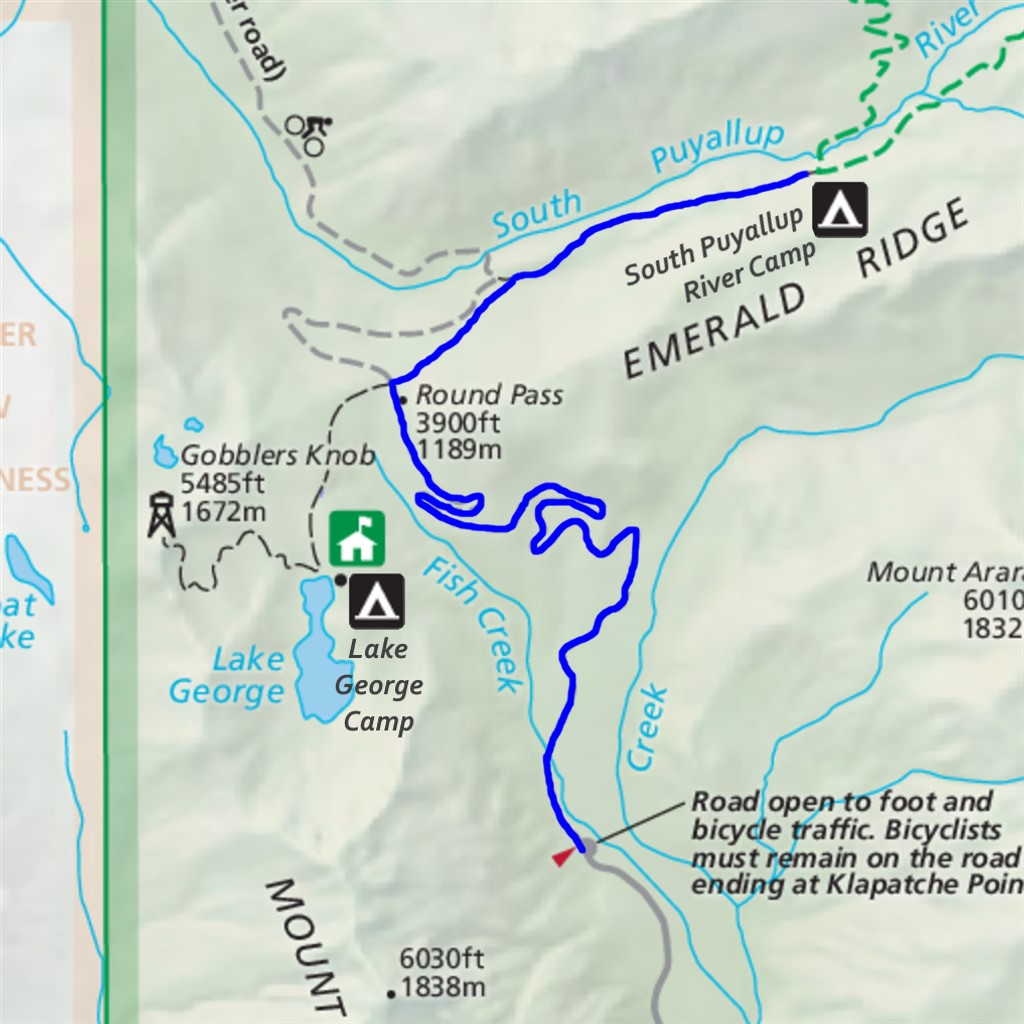
South Puyallup Pipe Organ Difficulty: moderate 11 miles Elevation gain: 2170' Max elevation: 4190' Camps: South Puyallup River First hiked by me: 2020 |
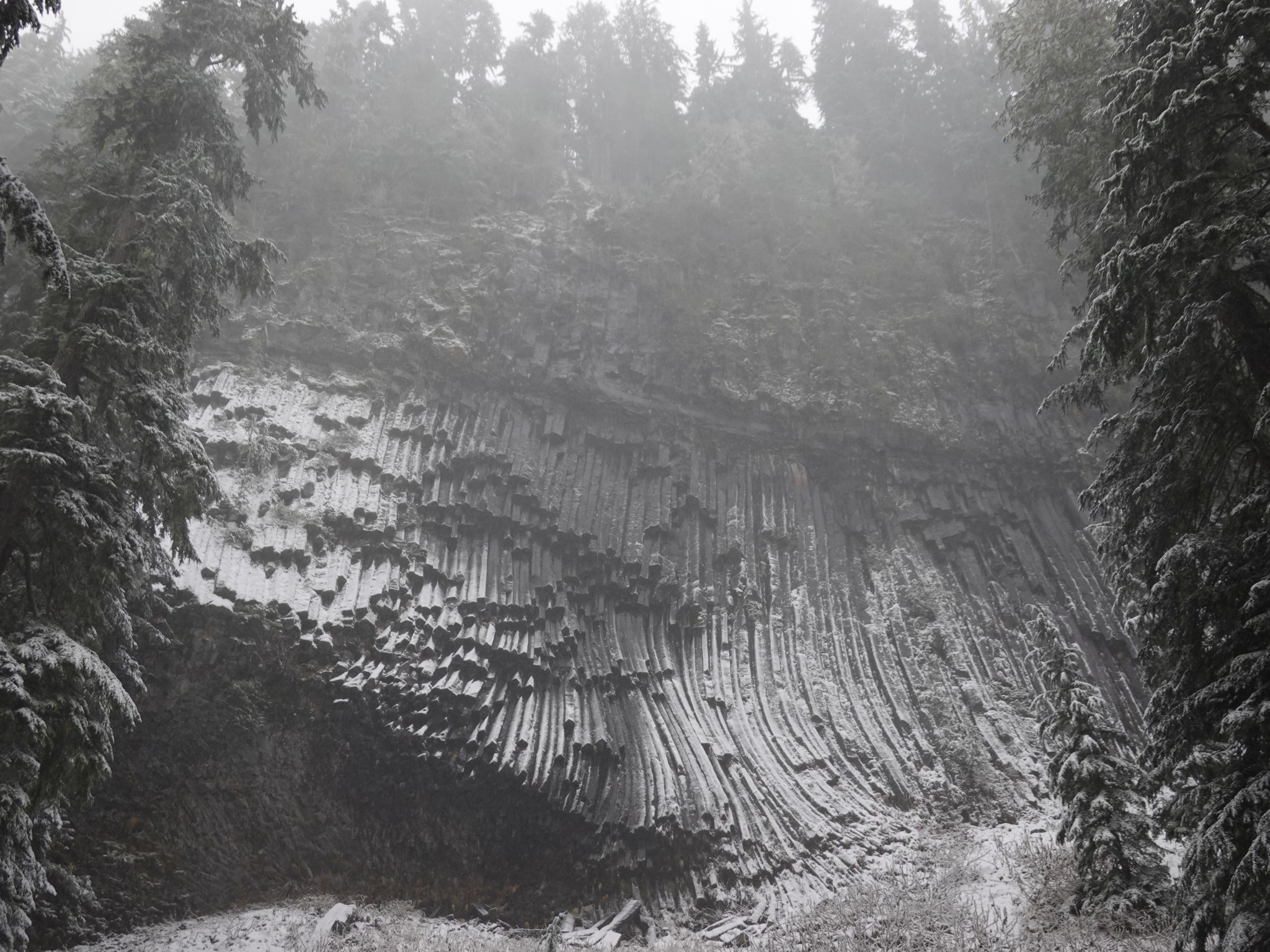
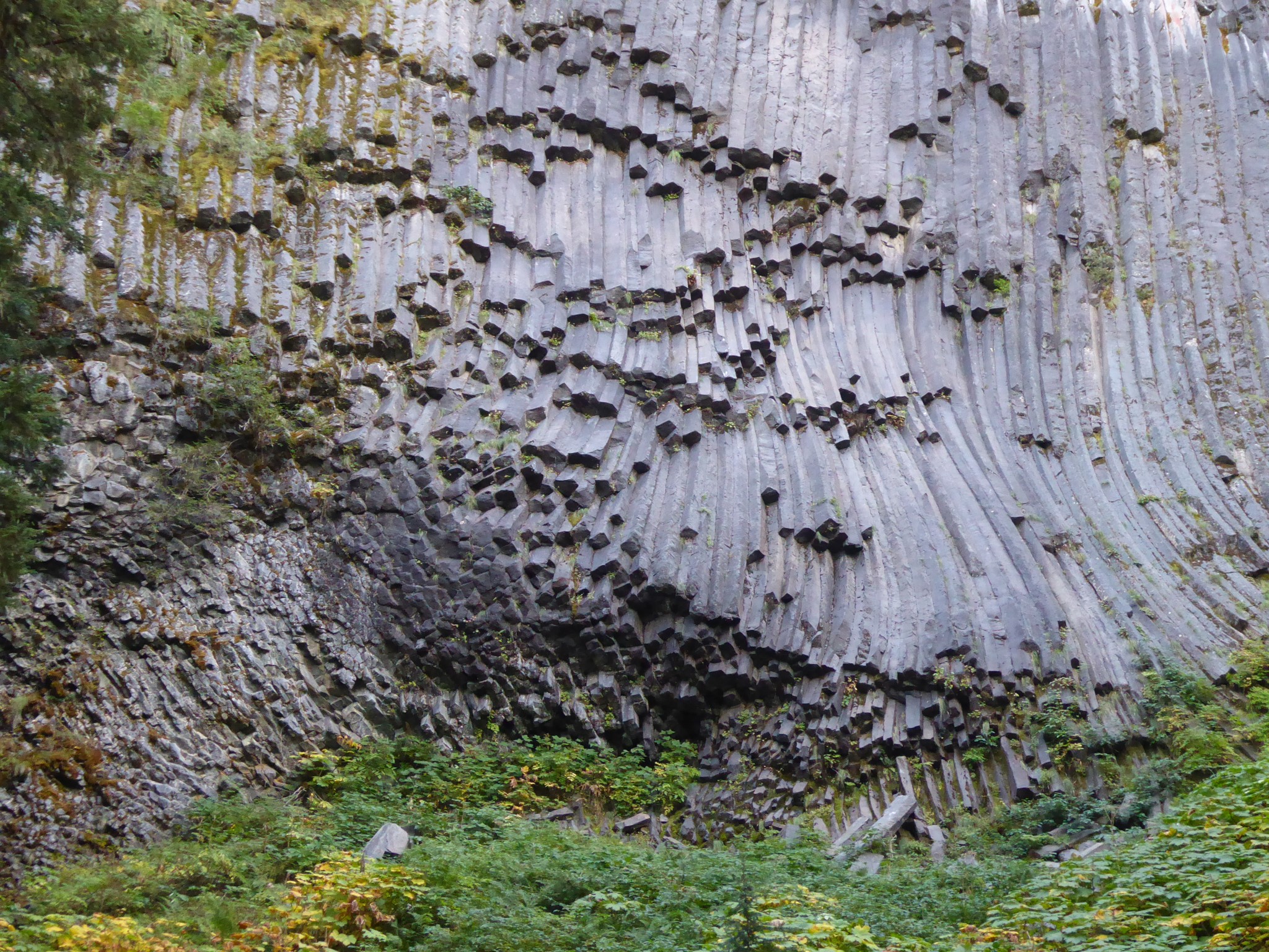
Hike or bike 3.5 miles up an abandoned road, then hike 2 miles along a delightful forest path, to a remarkable columnar andesite formation known as the Devil's Pipe Organ.
The Westside Road was originally planned as the first step toward a network of roads that would encircle the mountain. It starts near the southwest Nisqually entrance, and was intended to connect all the way to the Carbon River in the north, thus opening up the rugged west side of the park to the growing crowds of Rainier visitors. By 1932 construction had reached as far as the North Puyallup River, when high costs and shifting priorities led to this project being cancelled.
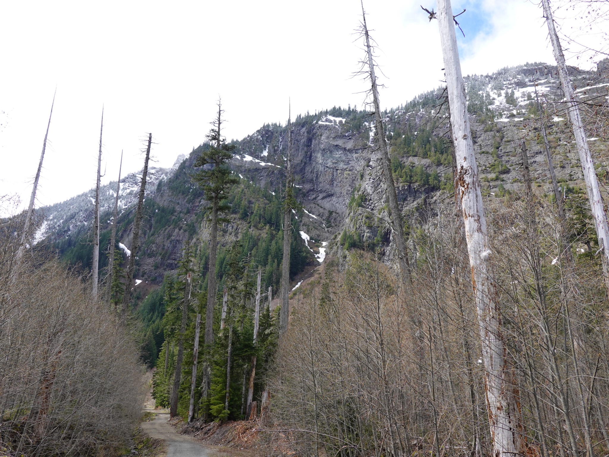
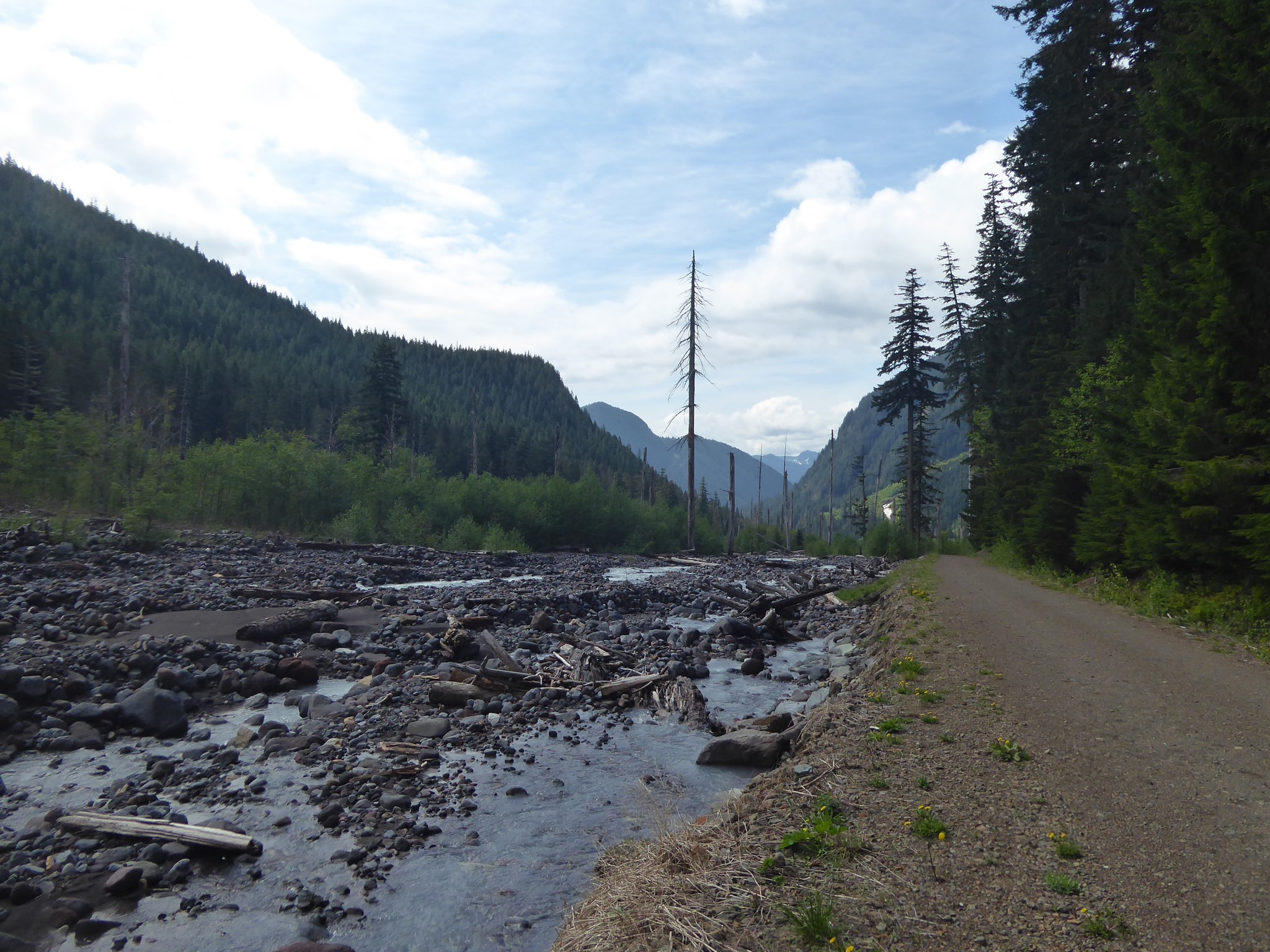
Rainier was not a fan of her west side being made more accessible. From miles three to four the road passes between Tahoma Creek and the cliffs of Mount Wow, and this is the most tectonically active region of the volcano. Steep cliffs plus earthquakes means boulders regularly being dropped onto the road below, while glacier-fed river plus earthquakes means frequent lahars (destructive mudflows). Over time the Tahoma Creek trail (which used to run alongside Tahoma Creek starting from the Westside Road) was abandoned, and in 1990 the road itself was closed to vehicles at Dry Creek. Remoteness restored!
Drive 3 miles up the Westside Road and park at the closure. Ignore the warning sign about entering an active geohazard zone, while marveling at the sights of lahar debris, rocks fallen from Mount Wow, and the wide valley of Tahoma Creek with its unusual population of killed yet still standing trees (root systems suffocated by the weight of mud and rocks dumped above them).
Mount Wow is named, not as you might guess for the expression commonly uttered by those seeing it for the first time, but after the Yakama word for 'goat'.
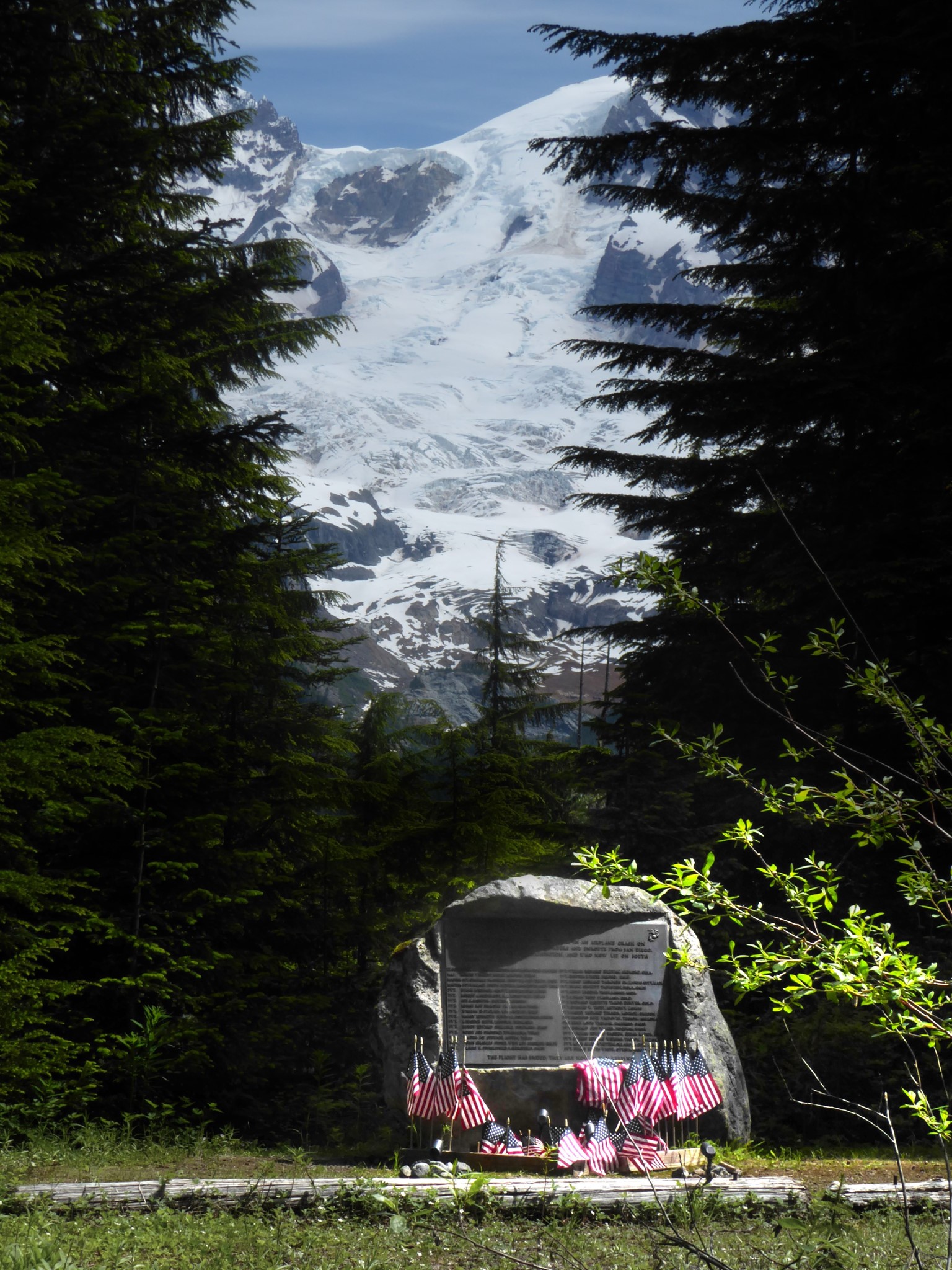
After leaving the hazard zone the road switchbacks gradually up to Round Pass, where you'll find the Marine Memorial. This is a boulder inscribed with the names of 32 men who died during a storm in December 1946, when their transport plane crashed into the South Tahoma Glacier at around 10,000'. The bodies were never recovered.
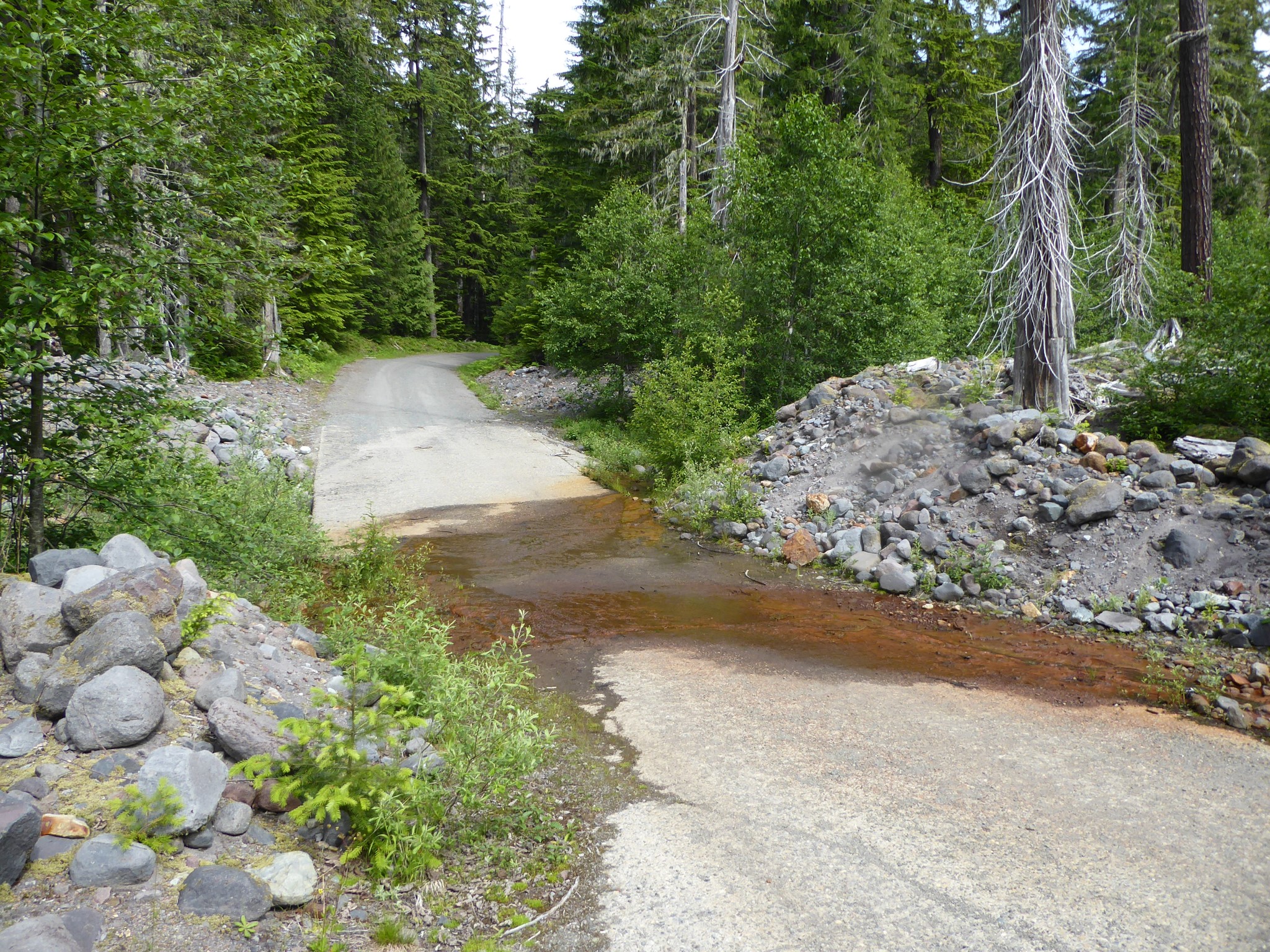
Shortly before the memorial, the Round Pass trail branches off to the right. It descends through forest before joining the South Puyallup trail, where you again turn right and climb gradually alongside (but with no views of) the river.
The highlight of this hike is the Devil's Pipe Organ, located opposite the toilet at South Puyallup River Camp. This is a hillside where andesite lava cooled into a hexagonal columnar formation. It's really quite amazing. Even the debris that's fallen away from the cliff over the years is perfectly hexagonal, with straight-edged artificial looking boulders littering the ground below.
A few hundred feet further, turn left onto the Wonderland Trail and descend a short distance for a nice view from the sturdy bridge over the South Puyallup River (no easily washed away log crossings here). Or continue another 4 miles to Klapatche Park. Or turn the other way and hike the Wonderland to Emerald Ridge.
The Westside Road portion of this trail doubles as the start of the Gobblers Knob hike.