Fairfax Bridge Closure
9 miles from the Carbon River trailhead and 18 miles from Mowich Lake, the Fairfax Bridge spans the steep-sided Carbon River valley, and provided the only road access to the northwest quarter of Mount Rainier National Park. Built in 1921, this historic steel arch has been steadily rusting away ever since. After years of concerning inspections, lack of funds for repair, and steadily increasing weight restrictions, WSDOT permanently closed the bridge in April 2025.
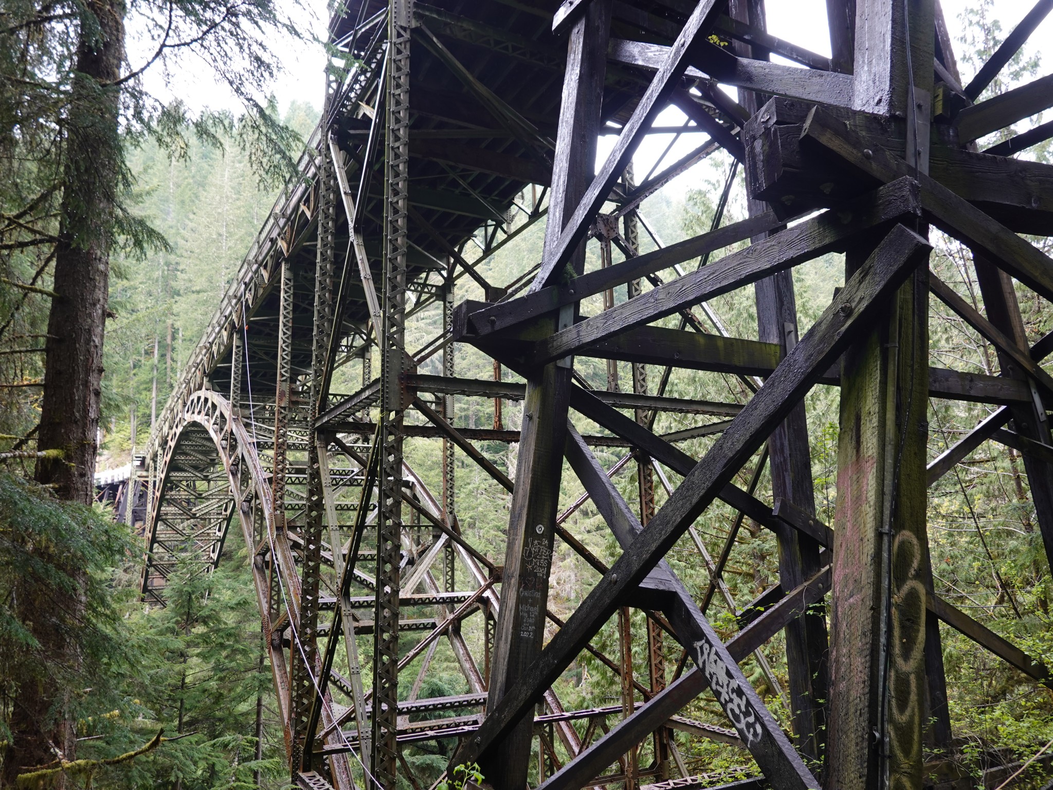 The Fairfax Bridge, built in 1921, now rusted away to unsafety |
Facts
Without the bridge, there is no longer road access to popular places such as Mowich Lake, Spray Park, Tolmie Peak, and the Carbon River.
This could change, but at least for now the Park Service has indicated that Mowich will be operated as a backcountry camp. Toilets will be open but not supplied with toilet paper. There'll be no trash pickup, and this is no longer a food cache location. The Carbon River ranger station will be minimally staffed, only as an emergency exit in case of injuries.
For Wonderlanders, this means the trail just got a lot harder. Rather than 3x sections each roughly 30 miles long, there's now one 30 mile section plus a 60 mile section. More food to carry. Fewer bailout options if your trip goes poorly.
The DOT is evaluating options, with the choices being do nothing, build a new bridge, or build a new road along some other route. Folk who know how such things work tell me the timeframe will be at least five years, i.e. best case 2030.
Pleading
There's an emergency route into the area, used by first responders, the Park Service, and the few residents (pity them!) who live on the far side of the failed bridge. This is not open to the public because it crosses private land and is a rough single lane that cannot sustain volumes of traffic. Please be respectful of the rules here. The desires of hikers won't be aided if those deciding on a final solution come to view us as rulebreakers who have antagonized the local community.
Some have suggested could the Park Service drive food caches up to Mowich from somewhere else? Perhaps if they were better funded, but not in the current climate with their current resources.
Others have suggested could you drop a cache in some unofficial location, perhaps North Puyallup accessed via the Westside Road? Although a long way to get there, this could work if you have a good enough friend to commit to an in-person supply handoff. Leaving food unattended in the wilderness is against regulations, and the Park Service has indicated they will remove any such noticed by rangers.
But I Have To Get To Mowich!
From Sunrise, it's 23 miles on foot. From Longmire, 34. From the Westside Road, 28 (partially bikeable).
From Carbonado, you could take the Melmont Ghost Town trail, which is 6.2 miles of usually very muddy dirtbike route to the Kolisch Bridge, then 5.3 miles of otherwise closed road to the Carbon River entrance. Going in this way would be 22.4 miles to Mowich, the first 16.8 of which is bikeable if you're ok with a rough, muddy, rooty route that crosses a few steep washout spots. This route passes beneath the failing Fairfax Bridge, so it's an open question whether someone might at some point get scared of that liability and decide to close it too.
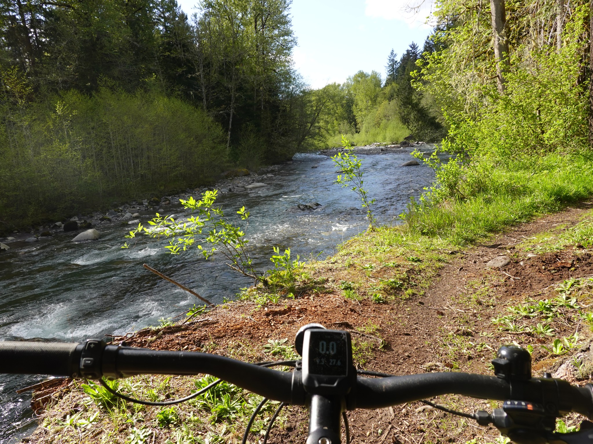 Biking up the Melmont Ghost Town trail | 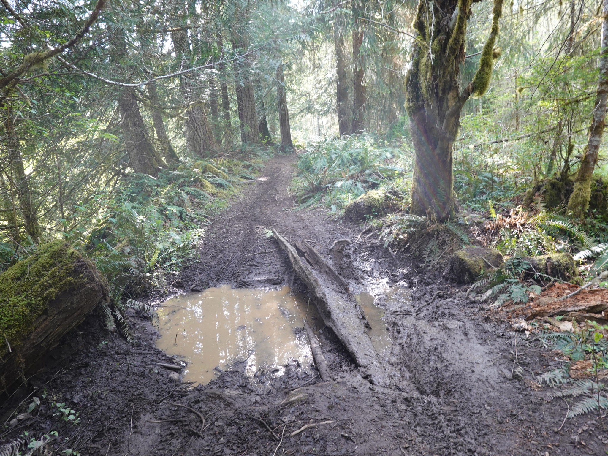 Mud patch along the Melmont Ghost Town trail |
Big Feelings
In case you can't tell, I love this mountain to bits. It breaks my heart that some of my absolute favorite places are no longer easily reachable or shareable with friends.
I'm angry that this is a direct result of years of underinvestment in infrastructure, leading to a retrenchment of access that nobody wanted. Such a failing of accountable governance.
At the same time, I'm kinda glad that these special places will have some quiet time to recover from their overuse. As someone who enjoys logistical challenges and the thrill of figuring out how to access hard-to-reach places, I'm kinda excited to have more such to strive for. I value deep wilderness, and am not entirely sad that Tahoma now has more of that.
Bigger picture, it concerns me that there's a broad trend of wilderness access retreating at the same time as our urban population and the popularity of hiking are growing. The Westside Road, Glacier View Wilderness, West Fork White River, so many more, and now this. Meanwhile the vast majority of the Cascades are owned by logging companies and closed to the public. This concentrates hikers into just a few places where they cause undue damage, and seems like the wrong way to be managing our natural resources.
Change is constant in the mountains. When I moved to Seattle in 2005 I bought the book "Day Hike Mount Rainier". It describes the Carbon Glacier Viewpoint as moderate difficulty, 7 miles round-trip, and "one of the easiest ways in Mount Rainier National Park to get up close and personal with a real, live glacier."
Before I'd gotten around to visiting there, the floods of 2006 led to the Carbon River Road being converted to a trail and Ipsut Creek car camp to a backcountry campsite. Thus the entry for Carbon Glacier on this website describing it as 17.8 miles roundtrip.
Shortly after the Fairfax Bridge was closed, I visited the Carbon Glacier overlook by biking up the Melmont Ghost Town trail. It was 41 miles roundtrip.
This has me wondering, will the trend continue? I'm reminded of a conversation with a friend who worked on trail maintenance, where they described feeling that Tahoma was a sleeping dragon and all our efforts at building and easing access could be eradicated at any moment by her slightest snoring twitch.
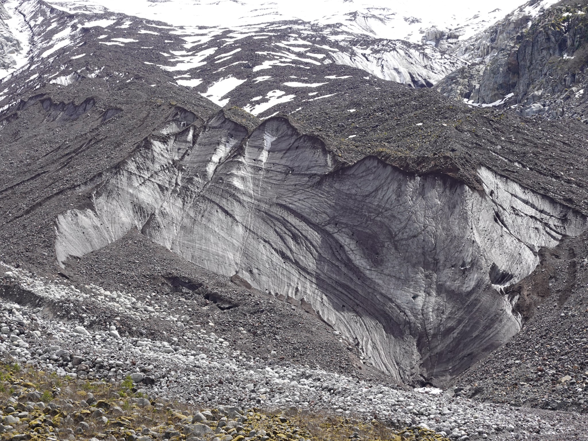 The Carbon Glacier: a 7 mile hike in 2005, or 18 miles in 2010, or 41 miles in 2025 |